|
search place name
|
||
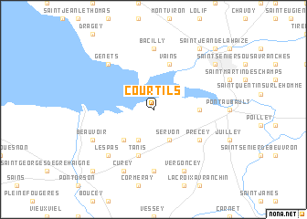
Courtils (Basse-Normandie, France)Courtils is a town in the Basse-Normandie region of France. An overview map of the region around Courtils is displayed below.
regional and 3d topo map of Courtils, France ::
Courtils airports ::
The nearest airport is DNR - Dinard Pleurtuit, located 48.0 km west of Courtils.
Other airports nearby include RNS - Rennes St Jacques (66.6 km south), LVA - Laval Entrammes (84.3 km south east), JER - Jersey (84.9 km north west), CFR - Caen Carpiquet (93.8 km north east), Nearby towns ::
Servon (3.9km south) //
Huisnes-sur-Mer (3.9km south) //
Ardevon (4.4km south west) //
Céaux (3.7km east) //
Vains (5.7km north) //
Tanis (5.7km south) //
Précey (5.2km south east) //
Macey (7.4km south) //
Bacilly (7.4km north) //
Les Pas (6.7km south west) //
Genêts (6.7km north west) //
Vergoncey (7.8km south) //
Curey (7.8km south) //
Beauvoir (6.1km south west) //
Avranches (7.4km north east) //
Marcey-les-Grèves (8.3km north east) //
Moidrey (8.9km south west) //
Saint-Jean-de-la-Haize (8.9km north east) //
[all distances 'as the bird flies' and approximate]  Places with similar names to Courtils, France ::
// Kreutles (DE)
// Caratales (PA)
// Cortellazzo (IT)
// Cardielos (PT)
// Grądy Łazy (PL)
// Krūtilės (LT)
// Çartallos (AL)
// Kurtalići (BA)
// Kurtuluş (TR)
// Kurtuluş (TR)
Disclaimer :: Information on this page comes without warranty of any kind |
||
|
Where is Courtils? Elevation and coordinates ::
Latitude (lat): 48°38'0"N Longitude (lon): 1°26'0"W
Elevation (approx.): 6m (map arrows pan, magnifying glasses zoom) |
||
|
Visiting Courtils? Hotel/Accommodation ::
Book a hotel in Courtils Travel Guide ::
Buy a travel guide for France rental cars ::
car rental offers GPS waypoint ::
download a GPX waypoint (PoI) of Courtils for your GPS receiver
|
||