|
search place name
|
||
Couzon-sur-Coulange (Champagne-Ardenne, France)Couzon-sur-Coulange is a town in the Champagne-Ardenne region of France. An overview map of the region around Couzon-sur-Coulange is displayed below.
regional and 3d topo map of Couzon-sur-Coulange, France ::

Couzon-sur-Coulange airports ::
The nearest airport is DIJ - Dijon Longvic, located 42.7 km south of Couzon-sur-Coulange.
Other airports nearby include DLE - Dole Tavaux (67.2 km south), XCD - Chalon Champforgeuil (96.0 km south), EPL - Epinal Mirecourt (97.5 km north east), QYR - Troyes Barberey (120.7 km north west), Nearby towns ::
Occey (1.9km south) //
Pressant (1.2km west) //
Aubigny-sur-Badin (1.9km north) //
Vaux-sous-Aubigny (2.2km north east) //
Isômes (3.1km north east) //
Prauthoy (3.9km north) //
Rivières-les-Fosses (4.5km north west) //
Boussenois (3.7km west) //
Chatoillenot (5.7km north) //
Montsaugeon (5.3km north east) //
Sacquenay (6.7km south east) //
Courcelles-Val-dʼEsnoms (7.8km north) //
Esnoms-au-Val (7.5km north west) //
[all distances 'as the bird flies' and approximate] 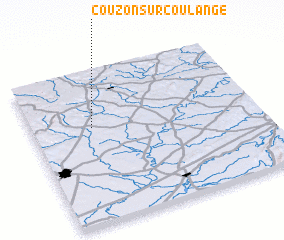 Places with similar names to Couzon-sur-Coulange, France :: Disclaimer :: Information on this page comes without warranty of any kind |
||
|
Where is Couzon-sur-Coulange? Elevation and coordinates ::
Latitude (lat): 47°38'0"N Longitude (lon): 5°16'0"E
Elevation (approx.): 312m (map arrows pan, magnifying glasses zoom) |
||
|
Visiting Couzon-sur-Coulange? Hotel/Accommodation ::
Book a hotel in Couzon-sur-Coulange Travel Guide ::
Buy a travel guide for France rental cars ::
car rental offers GPS waypoint ::
download a GPX waypoint (PoI) of Couzon-sur-Coulange for your GPS receiver
|
||