|
search place name
|
||
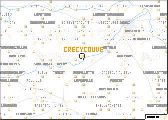
Crécy-Couvé (Centre, France)Crécy-Couvé is a town in the Centre region of France. An overview map of the region around Crécy-Couvé is displayed below.
regional and 3d topo map of Crécy-Couvé, France ::
Crécy-Couvé airports ::
The nearest airport is TNF - Toussous-le-noble Toussus Le Noble, located 61.3 km east of Crécy-Couvé.
Other airports nearby include POX - Pontoise Cormeilles En Vexin (73.3 km north east), ORY - Paris Orly (79.5 km east), URO - Rouen Vallee De Seine (80.2 km north), ORE - Orleans Bricy (83.4 km south east), Nearby towns ::
Saulnières (1.2km west) //
Aunay-sous-Crécy (1.2km east) //
La Brétonnière (2.4km west) //
Garancières-en-Drouais (3.7km north) //
Morvillette (3.7km south) //
Fontaine-les-Ribouts (3.1km south west) //
Criloup (3.9km south) //
Boutaincourt (4.4km north west) //
Bois-Bruneau (4.4km north west) //
Levasville (5.6km south) //
Champseru (5.6km north) //
Boutry (3.7km west) //
Fortisle (4.1km north east) //
Tréon (4.1km north east) //
Allainville (5.7km north) //
Saint-Jean-de-Rebervilliers (6.1km south west) //
Chataincourt (5.2km north west) //
Garnay (5.2km north east) //
Torçay (5.2km south west) //
Boullay-les-Deux-Églises (5.2km south east) //
Mondétour (5.2km south east) //
Louvilliers-en-Drouais (7.4km north) //
Neuville-les-Bois (4.9km west) //
Saint-Sauveur-Levasville (7.4km south) //
Boissy-en-Drouais (7.5km north) //
Saint-Ange-et-Torçay (5.2km west) //
Chambléan (5.2km east) //
Marville-les-Bois (7.5km south) //
Le Bois-le-Roi (6.7km north east) //
[all distances 'as the bird flies' and approximate] 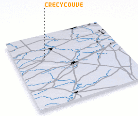 Places with similar names to Crécy-Couvé, France ::
Disclaimer :: Information on this page comes without warranty of any kind |
||
|
Where is Crécy-Couvé? Elevation and coordinates ::
Latitude (lat): 48°40'0"N Longitude (lon): 1°17'0"E
Elevation (approx.): 117m (map arrows pan, magnifying glasses zoom) |
||
|
Visiting Crécy-Couvé? Hotel/Accommodation ::
Book a hotel in Crécy-Couvé Travel Guide ::
Buy a travel guide for France rental cars ::
car rental offers GPS waypoint ::
download a GPX waypoint (PoI) of Crécy-Couvé for your GPS receiver
|
||