|
search place name
|
||
Crespin (Midi-Pyrénées, France)Crespin is a town in the Midi-Pyrénées region of France. An overview map of the region around Crespin is displayed below.
regional and 3d topo map of Crespin, France ::

Crespin airports ::
The nearest airport is LBI - Albi Le Sequestre, located 21.3 km south west of Crespin.
Other airports nearby include RDZ - Rodez Marcillac (42.4 km north), DCM - Castres Mazamet (54.9 km south), TLS - Toulouse Blagnac (88.6 km south west), CCF - Carcassonne Salvaza (92.7 km south), Nearby towns ::
Moularès (1.9km north) //
Lacapelle-Pinet (3.2km north east) //
Saint-Jean-de-Marcel (4.4km north west) //
Padiès (5.3km east) //
Tanus (7.4km north) //
Saussenac (7.5km south) //
Saint-Julien-Gaulène (6.8km south east) //
Tréban (6.8km north east) //
Valderiès (6.5km south west) //
Masclé (7.7km south west) //
Pampelonne (8.4km north west) //
[all distances 'as the bird flies' and approximate] 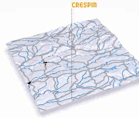 Places with similar names to Crespin, France ::
// Caarosipan (PH)
// Caarusipan (PH)
// Carusipan (PH)
// Carusipan (PH)
// Gorspen (DE)
// Groß Pinnow (DE)
// Kryspinów (PL)
// Krzepin (PL)
// Gorsi Pāīn (PK)
// Cross Pen (JM)
Disclaimer :: Information on this page comes without warranty of any kind |
||
|
Where is Crespin? Elevation and coordinates ::
Latitude (lat): 44°3'0"N Longitude (lon): 2°18'0"E
Elevation (approx.): 505m (map arrows pan, magnifying glasses zoom) |
||
|
Visiting Crespin? Hotel/Accommodation ::
Book a hotel in Crespin Travel Guide ::
Buy a travel guide for France rental cars ::
car rental offers GPS waypoint ::
download a GPX waypoint (PoI) of Crespin for your GPS receiver
|
||