|
search place name
|
||
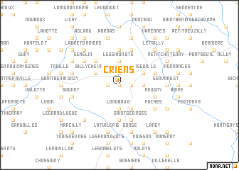
Criens (Bourgogne, France)Criens is a town in the Bourgogne region of France. An overview map of the region around Criens is displayed below.
regional and 3d topo map of Criens, France ::
Criens airports ::
The nearest airport is NVS - Nevers Fourchambault, located 28.1 km west of Criens.
Other airports nearby include XMU - Moulins Montbeugny (51.9 km south), BOU - Bourges (84.9 km west), VHY - Vichy Charmeil (92.5 km south), AUF - Auxerre Branches (94.5 km north), Nearby towns ::
Cizely (0.0km north) //
Nanteuil (1.3km west) //
La Perrière (1.3km east) //
Chevannes (1.9km north) //
Longboué (3.7km south) //
Bois Rétif (3.7km north) //
Les Simonots (3.7km north) //
Frasnay-Reugny (2.5km east) //
Billy-Chevannes (3.1km north west) //
Anlezy (3.9km south) //
Conseuille (3.1km north east) //
Patry (4.5km north west) //
Saxi-Bourdon (5.6km north) //
Chassy (5.6km south) //
Ville-Langy (5.7km south) //
Les Loges (5.7km north) //
Saint-Georges (5.7km south) //
Reugny (4.2km south east) //
Rouy (4.2km north east) //
Semelin (5.3km north west) //
Faches (5.3km south east) //
Servandet (5.1km east) //
Segoule (5.4km west) //
Sauvry (5.4km west) //
Mouceau (5.4km west) //
La Tuilerie (7.5km south) //
Pornas (7.5km north) //
Gonge (7.5km south) //
Merlauveau (7.5km north) //
[all distances 'as the bird flies' and approximate]  Places with similar names to Criens, France ::
Disclaimer :: Information on this page comes without warranty of any kind |
||
|
Where is Criens? Elevation and coordinates ::
Latitude (lat): 47°0'0"N Longitude (lon): 3°29'0"E
Elevation (approx.): 272m (map arrows pan, magnifying glasses zoom) |
||
|
Visiting Criens? Hotel/Accommodation ::
Book a hotel in Criens Travel Guide ::
Buy a travel guide for France rental cars ::
car rental offers GPS waypoint ::
download a GPX waypoint (PoI) of Criens for your GPS receiver
|
||