|
search place name
|
||
Dollemard (Haute-Normandie, France)Dollemard is a town in the Haute-Normandie region of France. An overview map of the region around Dollemard is displayed below.
regional and 3d topo map of Dollemard, France ::

Dollemard airports ::
The nearest airport is LEH - Le Havre Octeville, located 2.5 km north east of Dollemard.
Other airports nearby include DOL - Deauville St Gatien (18.0 km south), CFR - Caen Carpiquet (53.5 km south west), URO - Rouen Vallee De Seine (81.7 km east), CER - Cherbourg Maupertus (112.1 km west), Nearby towns ::
Ignauval (0.0km north) //
Le Grand Hameau (2.2km north east) //
Sainte-Adresse (2.2km south east) //
Bléville (2.4km east) //
Sanvic (2.4km east) //
Le Perrey (3.0km south east) //
Saint-Andrieux (4.4km north east) //
Octeville-sur-Mer (5.2km north east) //
Brière (6.1km north east) //
Le Havre (5.2km east) //
LʼEure (6.1km south east) //
Ecqueville (8.2km north east) //
Saint-Supplix (7.4km north east) //
Le Tronquay (8.8km north east) //
[all distances 'as the bird flies' and approximate] 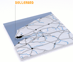 Places with similar names to Dollemard, France ::
// Del Muerto (US)
// Tol-e Morādī (IR)
// Dil Murād (PK)
// Dil Murād (PK)
// Dil Murād (PK)
// Tilmirat (MA)
Disclaimer :: Information on this page comes without warranty of any kind |
||
|
Where is Dollemard? Elevation and coordinates ::
Latitude (lat): 49°31'0"N Longitude (lon): 0°4'0"W
Elevation (approx.): 72m (map arrows pan, magnifying glasses zoom) |
||
|
Visiting Dollemard? Hotel/Accommodation ::
Book a hotel in Dollemard Travel Guide ::
Buy a travel guide for France rental cars ::
car rental offers GPS waypoint ::
download a GPX waypoint (PoI) of Dollemard for your GPS receiver
|
||