|
search place name
|
||
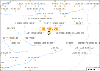
Dolmayrac (Aquitaine, France)Dolmayrac is a town in the Aquitaine region of France. An overview map of the region around Dolmayrac is displayed below.
regional and 3d topo map of Dolmayrac, France ::
Dolmayrac airports ::
The nearest airport is AGF - Agen La Garenne, located 21.3 km south of Dolmayrac.
Other airports nearby include EGC - Bergerac Roumaniere (51.2 km north), PGX - Perigueux Bassillac (94.2 km north), TLS - Toulouse Blagnac (103.1 km south east), BVE - Brive La Roche (111.9 km north east), Nearby towns ::
Cours (3.7km south) //
Sainte-Livrade-sur-Lot (3.9km north) //
Allez-et-Cazeneuve (4.6km north east) //
Saint-Médard (4.6km south west) //
Le Temple-sur-Lot (4.0km west) //
Laugnac (5.7km south) //
Saint-Étienne-de-Fougères (6.2km north west) //
Sainte-Colombe-de-Villeneuve (5.3km east) //
Pinel-Hauterive (7.5km north) //
Montpezat (5.6km west) //
Sembas (6.5km south east) //
Paulhiac (8.4km north east) //
[all distances 'as the bird flies' and approximate] 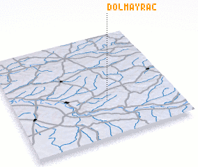 Places with similar names to Dolmayrac, France ::
Disclaimer :: Information on this page comes without warranty of any kind |
||
|
Where is Dolmayrac? Elevation and coordinates ::
Latitude (lat): 44°22'0"N Longitude (lon): 0°35'0"W
Elevation (approx.): 106m (map arrows pan, magnifying glasses zoom) |
||
|
Visiting Dolmayrac? Hotel/Accommodation ::
Book a hotel in Dolmayrac Travel Guide ::
Buy a travel guide for France rental cars ::
car rental offers GPS waypoint ::
download a GPX waypoint (PoI) of Dolmayrac for your GPS receiver
|
||