|
search place name
|
||
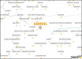
Domprel (Franche-Comté, France)Domprel is a town in the Franche-Comté region of France. An overview map of the region around Domprel is displayed below.
regional and 3d topo map of Domprel, France ::
Domprel airports ::
The nearest airport is DLE - Dole Tavaux, located 80.9 km west of Domprel.
Other airports nearby include BRN - Bern Belp (84.5 km east), MLH - Bale Mulhouse (91.2 km north east), DIJ - Dijon Longvic (104.5 km west), GVA - Geneva Cointrin (110.4 km south), Nearby towns ::
Germéfontaine (1.9km north) //
Grandfontaine-sur-Creuse (1.3km west) //
Eysson (2.5km west) //
Villers-la-Combe (3.9km north) //
Villers-Chief (3.9km north) //
Longechaux (4.5km south west) //
Landresse (5.6km north) //
Vellerot-lès-Vercel (5.7km north) //
La Sommette (4.2km south east) //
Loray (6.1km south east) //
Flangebouche (7.4km south) //
Épenouse (5.4km west) //
Vercel-Villedieu-le-Camp (5.4km west) //
Courtetain-et-Salans (6.7km north west) //
Brémondans (6.3km north west) //
Adam-lès-Vercel (6.3km south west) //
Avoudrey (7.8km south) //
Orchamps-Vennes (9.0km south east) //
[all distances 'as the bird flies' and approximate]  Places with similar names to Domprel, France ::
Disclaimer :: Information on this page comes without warranty of any kind |
||
|
Where is Domprel? Elevation and coordinates ::
Latitude (lat): 47°12'0"N Longitude (lon): 6°28'0"E
Elevation (approx.): 701m (map arrows pan, magnifying glasses zoom) |
||
|
Visiting Domprel? Hotel/Accommodation ::
Book a hotel in Domprel Travel Guide ::
Buy a travel guide for France rental cars ::
car rental offers GPS waypoint ::
download a GPX waypoint (PoI) of Domprel for your GPS receiver
|
||