|
search place name
|
||
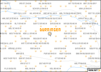
Durningen (Alsace, France)Durningen is a town in the Alsace region of France. An overview map of the region around Durningen is displayed below.
regional and 3d topo map of Durningen, France ::
Durningen airports ::
The nearest airport is SXB - Strassbourg Entzheim, located 16.8 km south of Durningen.
Other airports nearby include ZCC - Baden-baden Baden Oos (47.2 km east), CMR - Colmar Houssen (65.6 km south), SCN - Saarbruecken Saarbrucken (67.9 km north west), RMS - Ramstein Ab (83.8 km north), Nearby towns ::
Kienheim (1.2km east) //
Gougenheim (1.9km north) //
Kleinfrankenheim (2.2km south east) //
Schnersheim (2.2km south east) //
Avenheim (2.2km south west) //
Ittlenheim (2.2km south west) //
Rohr (2.2km north west) //
Truchtersheim (3.1km south east) //
Gingsheim (3.9km north) //
Neugartheim (3.1km south west) //
Kuttolsheim (4.4km south west) //
Duntzenheim (4.4km north west) //
Schaffhouse-sur-Zorn (5.6km north) //
Reitwiller (3.7km east) //
Dossenheim-Kochersberg (5.6km south) //
Quatzenheim (5.6km south) //
Mutzenhouse (5.7km north) //
Hohfrankenheim (5.7km north) //
Willgottheim (4.1km south west) //
Gimbrett (4.1km north east) //
Saessolsheim (4.1km north west) //
Wintzenheim-Kochersberg (5.2km south west) //
Behlenheim (5.2km south east) //
Wiwersheim (6.1km south east) //
Hohatzenheim (5.2km north east) //
Fessenheim-le-Bas (6.1km south west) //
Furdenheim (7.4km south) //
Rumersheim (4.9km east) //
Hochfelden (7.4km north) //
[all distances 'as the bird flies' and approximate]  Places with similar names to Durningen, France ::
// Deurningen (NL)
Disclaimer :: Information on this page comes without warranty of any kind |
||
|
Where is Durningen? Elevation and coordinates ::
Latitude (lat): 48°41'0"N Longitude (lon): 7°34'0"E
Elevation (approx.): 247m (map arrows pan, magnifying glasses zoom) |
||
|
Visiting Durningen? Hotel/Accommodation ::
Book a hotel in Durningen Travel Guide ::
Buy a travel guide for France rental cars ::
car rental offers GPS waypoint ::
download a GPX waypoint (PoI) of Durningen for your GPS receiver
|
||