|
search place name
|
||
Ensisheim (Alsace, France)Ensisheim is a town in the Alsace region of France. An overview map of the region around Ensisheim is displayed below.
regional and 3d topo map of Ensisheim, France ::

Ensisheim airports ::
The nearest airport is CMR - Colmar Houssen, located 27.0 km north of Ensisheim.
Other airports nearby include MLH - Bale Mulhouse (33.6 km south east), SXB - Strassbourg Entzheim (77.5 km north), ZQL - Donaueschingen Villingen (88.4 km east), ZRH - Zurich (100.5 km south east), Nearby towns ::
Reguisheim (3.7km north) //
Ungersheim (3.1km north west) //
Ruelisheim (3.9km south) //
Battenheim (4.5km south east) //
Munwiller (5.6km north) //
Meyenheim (5.6km north) //
Pulversheim (4.2km south west) //
Cité-Sainte-Barbe (5.7km south) //
Wittenheim (5.7km south) //
Feldkirch (5.0km west) //
Raedersheim (5.3km west) //
Kingersheim (7.5km south) //
Baldersheim (7.5km south) //
Gundolsheim (6.7km north west) //
Merxheim (7.5km north west) //
[all distances 'as the bird flies' and approximate] 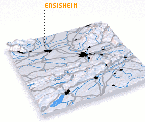 Places with similar names to Ensisheim, France :: Disclaimer :: Information on this page comes without warranty of any kind |
||
|
Where is Ensisheim? Elevation and coordinates ::
Latitude (lat): 47°52'0"N Longitude (lon): 7°21'0"E
Elevation (approx.): 215m (map arrows pan, magnifying glasses zoom) |
||
|
Visiting Ensisheim? Hotel/Accommodation ::
Book a hotel in Ensisheim Travel Guide ::
Buy a travel guide for France rental cars ::
car rental offers GPS waypoint ::
download a GPX waypoint (PoI) of Ensisheim for your GPS receiver
|
||