|
search place name
|
||
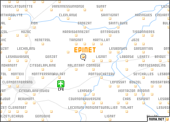
Épinet (Auvergne, France)Épinet is a town in the Auvergne region of France. An overview map of the region around Épinet is displayed below.
regional and 3d topo map of Épinet, France ::
Épinet airports ::
The nearest airport is CFE - Clermont Ferrand Auvergne, located 6.4 km south west of Épinet.
Other airports nearby include VHY - Vichy Charmeil (40.1 km north), RNE - Roanne Renaison (65.8 km north east), MCU - Montlucon Domerat (76.3 km north west), MCU - Montlucon-gueret Montlucon Gueret (78.9 km north west), Nearby towns ::
Lussat (1.3km east) //
Cormède (2.3km south east) //
Malintrat (2.3km south west) //
Lignat (2.6km east) //
Puy Chany (3.7km north) //
Chappes (3.9km north) //
Saint-Beauzire (3.2km north west) //
Targnat (3.9km north) //
Pont-du-Château (4.5km south east) //
Martillat (4.5km north east) //
Martres-dʼArtières (3.9km east) //
Marais dʼEnnezat (5.7km north) //
Chavaroux (4.3km north east) //
Aulnat (5.4km south west) //
Gravanches (5.4km south west) //
Lempdes (7.4km south) //
Ennezat (7.4km north) //
Gerzat (5.2km west) //
Dallet (7.5km south) //
Les Bordes (5.5km east) //
Entraigues (6.8km north east) //
Chignat (6.8km south east) //
Le Fossat (7.6km south east) //
Saint-Laure (9.0km north east) //
[all distances 'as the bird flies' and approximate] 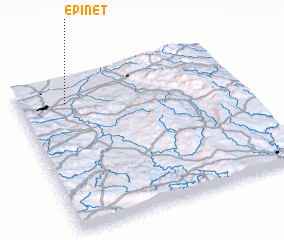
Disclaimer :: Information on this page comes without warranty of any kind |
||
|
Where is Épinet? Elevation and coordinates ::
Latitude (lat): 45°50'0"N Longitude (lon): 3°13'0"E
Elevation (approx.): 316m (map arrows pan, magnifying glasses zoom) |
||
|
Visiting Épinet? Hotel/Accommodation ::
Book a hotel in Épinet Travel Guide ::
Buy a travel guide for France rental cars ::
car rental offers GPS waypoint ::
download a GPX waypoint (PoI) of Épinet for your GPS receiver
|
||