|
search place name
|
||
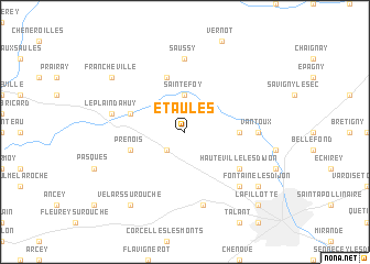
Étaules (Bourgogne, France)Étaules is a town in the Bourgogne region of France. An overview map of the region around Étaules is displayed below.
regional and 3d topo map of Étaules, France ::
Étaules airports ::
The nearest airport is DIJ - Dijon Longvic, located 18.0 km south east of Étaules.
Other airports nearby include DLE - Dole Tavaux (54.0 km south east), XCD - Chalon Champforgeuil (64.6 km south), AUF - Auxerre Branches (120.1 km north west), QNX - Macon Charnay (123.4 km south), Nearby towns ::
Darois (2.2km south west) //
Sainte-Foy (3.7km north) //
Messigny (3.8km east) //
Prenois (4.2km south west) //
Val-Suzon (4.2km north west) //
Curtil-Saint-Seine (5.7km north) //
Hauteville-lès-Dijon (5.3km south east) //
Saussy (7.4km north) //
Vantoux (5.0km east) //
Plombières-lès-Dijon (7.5km south) //
Le Plain dʼAhuy (5.3km west) //
Daix (6.7km south east) //
Fontaine-lès-Dijon (7.5km south east) //
Velars-sur-Ouche (8.3km south west) //
Francheville (7.5km north west) //
La Fillotte (9.0km south east) //
[all distances 'as the bird flies' and approximate] 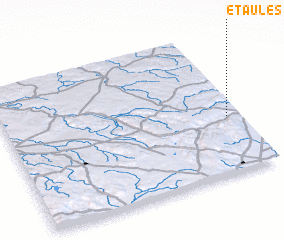 Places with similar names to Étaules, France ::
Disclaimer :: Information on this page comes without warranty of any kind |
||
|
Where is Étaules? Elevation and coordinates ::
Latitude (lat): 47°24'0"N Longitude (lon): 4°57'0"E
Elevation (approx.): 508m (map arrows pan, magnifying glasses zoom) |
||
|
Visiting Étaules? Hotel/Accommodation ::
Book a hotel in Étaules Travel Guide ::
Buy a travel guide for France rental cars ::
car rental offers GPS waypoint ::
download a GPX waypoint (PoI) of Étaules for your GPS receiver
|
||