|
search place name
|
||
Fégréac (Pays de la Loire, France)Fégréac is a town in the Pays de la Loire region of France. An overview map of the region around Fégréac is displayed below.
regional and 3d topo map of Fégréac, France ::

Fégréac airports ::
The nearest airport is SNR - St.-nazaire Montoir, located 31.1 km south of Fégréac.
Other airports nearby include VNE - Vannes Meucon (52.6 km west), NTE - Nantes Atlantique (58.2 km south east), RNS - Rennes St Jacques (59.0 km north east), CET - Cholet Le Pontreau (104.7 km south east), Nearby towns ::
Le Vieille Ville (3.8km east) //
Quinssignac (5.7km north) //
Rieux (4.2km north west) //
Sévérac (6.1km south west) //
Saint-Gildas-des-Bois (7.5km south) //
Théhillac (5.3km west) //
Saint-Nicolas-de-Redon (7.5km north) //
La Provotaie (7.5km north) //
Ronde Bruère (5.3km east) //
Auquefer (6.7km north west) //
La Polhaie (7.8km south) //
Redon (7.8km north) //
Coisnauté (6.2km south east) //
Marongle (6.2km south east) //
Le Val (6.2km north west) //
Avessac (8.9km north east) //
[all distances 'as the bird flies' and approximate] 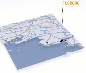 Places with similar names to Fégréac, France ::
// Vechrik (RU)
// Faqirūk (IQ)
// Vacariça (PT)
// Vacariça (PT)
// Väike-Rakke (EE)
// Veckārķi (LV)
// Vicárregui (ES)
// Vega Rica (CO)
// Vega Rica (CO)
// Vegarrica (CO)
Disclaimer :: Information on this page comes without warranty of any kind |
||
|
Where is Fégréac? Elevation and coordinates ::
Latitude (lat): 47°35'0"N Longitude (lon): 2°3'0"W
Elevation (approx.): 20m (map arrows pan, magnifying glasses zoom) |
||
|
Visiting Fégréac? Hotel/Accommodation ::
Book a hotel in Fégréac Travel Guide ::
Buy a travel guide for France rental cars ::
car rental offers GPS waypoint ::
download a GPX waypoint (PoI) of Fégréac for your GPS receiver
|
||