|
search place name
|
||
Fépin (Champagne-Ardenne, France)Fépin is a town in the Champagne-Ardenne region of France. An overview map of the region around Fépin is displayed below.
regional and 3d topo map of Fépin, France ::

Fépin airports ::
The nearest airport is CRL - Charleroi Brussels South, located 53.1 km north of Fépin.
Other airports nearby include LGG - Liege (85.6 km north east), RHE - Reims Champagne (92.8 km south west), BRU - Brussels Natl (Melsbroek) (100.0 km north), LUX - Luxemburg Luxembourg (114.9 km east), Nearby towns ::
Haybes (2.2km south west) //
Montigny-sur-Meuse (3.9km north) //
Fumay (4.4km south west) //
Hargnies (3.6km east) //
Chestion (4.0km south west) //
Vireux-Wallerand (7.4km north) //
Vireux-Molhain (7.5km north) //
Le Mesnil (5.1km west) //
Trou du Diable (5.1km west) //
Les Elmonts (8.2km north west) //
Les Vieux Moulins dʼHargnies (8.2km south east) //
Galerie Saint-Joseph (8.8km north west) //
Les Gettages (8.8km north west) //
Les Vieux Moulins de Thilay (8.8km south east) //
[all distances 'as the bird flies' and approximate] 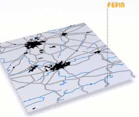 Places with similar names to Fépin, France ::
Disclaimer :: Information on this page comes without warranty of any kind |
||
|
Where is Fépin? Elevation and coordinates ::
Latitude (lat): 50°1'0"N Longitude (lon): 4°44'0"E
Elevation (approx.): 147m (map arrows pan, magnifying glasses zoom) |
||
|
Visiting Fépin? Hotel/Accommodation ::
Book a hotel in Fépin Travel Guide ::
Buy a travel guide for France rental cars ::
car rental offers GPS waypoint ::
download a GPX waypoint (PoI) of Fépin for your GPS receiver
|
||