|
search place name
|
||
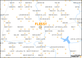
Flassy (Bourgogne, France)Flassy is a town in the Bourgogne region of France. An overview map of the region around Flassy is displayed below.
regional and 3d topo map of Flassy, France ::
Flassy airports ::
The nearest airport is NVS - Nevers Fourchambault, located 39.0 km south west of Flassy.
Other airports nearby include AUF - Auxerre Branches (68.6 km north), XMU - Moulins Montbeugny (77.9 km south), BOU - Bourges (87.9 km west), XCD - Chalon Champforgeuil (109.9 km south east), Nearby towns ::
Neuilly (0.0km north) //
Saint-Révérien (1.9km south) //
Champallement (1.3km west) //
Thory (2.5km west) //
Les Bordes (2.5km east) //
Brèches (3.1km south east) //
Les Angles (3.9km south) //
Sancenay (3.9km south) //
Assarts (3.9km south) //
Beaulieu (3.1km north east) //
Michaugues (3.9km north) //
Les Bouillons (4.5km south west) //
Bussy-la-Pesle (4.5km north west) //
Chailluée (5.6km south) //
Priez (3.8km west) //
Courcelles (5.6km north) //
Brinon-sur-Beuvron (5.6km north) //
Marciges (4.2km south west) //
Chanteloup (4.2km north east) //
Busseaux (5.3km south west) //
Mavé (6.1km north east) //
Treigny (5.3km north west) //
Forcy (7.4km south) //
Champlin (5.0km west) //
Crux-la-Ville (7.5km south) //
Montenoison (5.4km west) //
La Brosse (5.4km east) //
Beaumont (5.4km east) //
Taconnay (7.5km north) //
[all distances 'as the bird flies' and approximate] 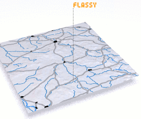 Places with similar names to Flassy, France ::
Disclaimer :: Information on this page comes without warranty of any kind |
||
|
Where is Flassy? Elevation and coordinates ::
Latitude (lat): 47°14'0"N Longitude (lon): 3°30'0"E
Elevation (approx.): 259m (map arrows pan, magnifying glasses zoom) |
||
|
Visiting Flassy? Hotel/Accommodation ::
Book a hotel in Flassy Travel Guide ::
Buy a travel guide for France rental cars ::
car rental offers GPS waypoint ::
download a GPX waypoint (PoI) of Flassy for your GPS receiver
|
||