|
search place name
|
||
Folkling (Lorraine, France)Folkling is a town in the Lorraine region of France. An overview map of the region around Folkling is displayed below.
regional and 3d topo map of Folkling, France ::

Folkling airports ::
The nearest airport is SCN - Saarbruecken Saarbrucken, located 16.9 km north east of Folkling.
Other airports nearby include ETZ - Metz Nancy Lorraine (50.9 km west), MZM - Metz Frescaty (56.8 km west), RMS - Ramstein Ab (60.1 km north east), ENC - Nancy Essey (70.7 km south west), Nearby towns ::
Théding (1.9km south) //
Oeting (2.2km north east) //
Forbach (3.7km north) //
Morsbach (3.1km north west) //
Diebling (4.4km south east) //
Tenteling (4.4km south east) //
Marienau (4.4km north west) //
Farschviller (5.6km south) //
Bousbach (3.6km east) //
Cocheren (3.6km west) //
Behren-lès-Forbach (4.1km north east) //
Rosbruck (4.1km north west) //
Farébersviller (5.2km south west) //
Emmersweiler (5.2km north west) //
Stiring-Wendel (6.1km north east) //
Krughütte (7.4km north) //
Naßweiler (4.8km west) //
Klarenthal (7.5km north) //
Loupershouse (7.5km south) //
Schoeneck (7.5km north) //
Kerbach (5.2km east) //
Béning-lès-Saint-Avold (5.2km west) //
Henriville (6.6km south west) //
Großrosseln (6.6km north west) //
Nousseviller-Saint-Nabor (6.1km south east) //
Seingbouse (6.1km south west) //
Vieux-Stiring (7.8km north) //
Etzling (6.1km north east) //
Metzing (7.4km south east) //
[all distances 'as the bird flies' and approximate] 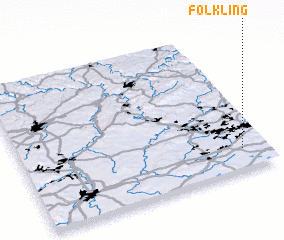 Places with similar names to Folkling, France ::
// Fula Kolong (GM)
// Vlkolínec (SK)
Disclaimer :: Information on this page comes without warranty of any kind |
||
|
Where is Folkling? Elevation and coordinates ::
Latitude (lat): 49°9'0"N Longitude (lon): 6°54'0"E
Elevation (approx.): 324m (map arrows pan, magnifying glasses zoom) |
||
|
Visiting Folkling? Hotel/Accommodation ::
Book a hotel in Folkling Travel Guide ::
Buy a travel guide for France rental cars ::
car rental offers GPS waypoint ::
download a GPX waypoint (PoI) of Folkling for your GPS receiver
|
||