|
search place name
|
||
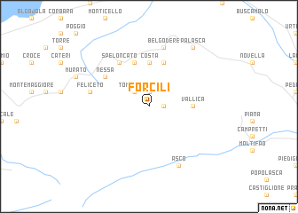
Forcili (France)Forcili is a town in France. An overview map of the region around Forcili is displayed below.
regional and 3d topo map of Forcili, France ::
Forcili airports ::
The nearest airport is CLY - Calvi Saint Catherine, located 17.1 km west of Forcili.
Other airports nearby include BIA - Bastia Poretta (39.9 km east), AJA - Ajaccio Campo Dell Oro (67.9 km south), SOZ - Solenzara (73.8 km south east), EBA - Marina Di Campo (105.2 km east), Nearby towns ::
Pioggiola (1.9km north) //
Mausoléo (1.4km east) //
Olmi-Cappella (1.4km east) //
Tombolaca (2.3km north west) //
Costa (5.6km north) //
Vallica (4.1km east) //
Occhiatana (5.7km north) //
Ville-di-Paraso (5.7km north) //
Speloncato (6.2km north west) //
Nessa (5.5km north west) //
Belgodère (7.5km north) //
Feliceto (5.8km west) //
Asco (7.9km south) //
Palasca (8.5km north east) //
[all distances 'as the bird flies' and approximate]  Places with similar names to Forcili, France ::
Disclaimer :: Information on this page comes without warranty of any kind |
||
|
Where is Forcili? Elevation and coordinates ::
Latitude (lat): 42°31'0"N Longitude (lon): 9°0'0"E
Elevation (approx.): 954m (map arrows pan, magnifying glasses zoom) |
||
|
Visiting Forcili? Hotel/Accommodation ::
Book a hotel in Forcili Travel Guide ::
Buy a travel guide for France rental cars ::
car rental offers GPS waypoint ::
download a GPX waypoint (PoI) of Forcili for your GPS receiver
|
||