|
search place name
|
||
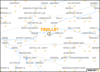
Fouilloy (Picardie, France)Fouilloy is a town in the Picardie region of France. An overview map of the region around Fouilloy is displayed below.
regional and 3d topo map of Fouilloy, France ::
Fouilloy airports ::
The nearest airport is BVA - Beauvais Tille, located 56.9 km south west of Fouilloy.
Other airports nearby include CSF - Creil (71.9 km south), LIL - Lille Lesquin (84.8 km north east), LTQ - Le Tourquet Le Touquet Paris Plage (93.0 km north west), POX - Pontoise Cormeilles En Vexin (95.3 km south), Nearby towns ::
Aubigny (1.2km west) //
Corbie (1.9km north) //
Hamelet (2.4km east) //
Villers-Bretonneux (3.9km south) //
Bonnay (3.9km north) //
Daours (3.6km west) //
Cachy (5.7km south) //
Vecquemont (4.0km south west) //
Vaire-sous-Corbie (4.0km north east) //
Vaux-sur-Somme (4.0km north east) //
Lahoussoye (5.7km north) //
Pont-Noyelles (5.2km north west) //
Heilly (6.1km north east) //
Franvillers (7.4km north) //
Le Hamel (5.1km east) //
Bussy-lès-Daours (5.1km west) //
Gentelles (6.6km south west) //
Marcelcave (7.3km south east) //
Montigny-sur-lʼHallue (8.2km north west) //
Aubercourt (8.2km south east) //
Méricourt-lʼAbbé (7.3km north east) //
Ribemont-sur-lʼAncre (7.3km north east) //
Fréchencourt (7.3km north west) //
Béhencourt (8.8km north west) //
Ignaucourt (8.8km south east) //
[all distances 'as the bird flies' and approximate]  Places with similar names to Fouilloy, France ::
Disclaimer :: Information on this page comes without warranty of any kind |
||
|
Where is Fouilloy? Elevation and coordinates ::
Latitude (lat): 49°54'0"N Longitude (lon): 2°30'0"E
Elevation (approx.): 35m (map arrows pan, magnifying glasses zoom) |
||
|
Visiting Fouilloy? Hotel/Accommodation ::
Book a hotel in Fouilloy Travel Guide ::
Buy a travel guide for France rental cars ::
car rental offers GPS waypoint ::
download a GPX waypoint (PoI) of Fouilloy for your GPS receiver
|
||