|
search place name
|
||
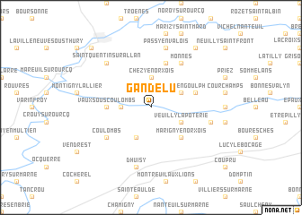
Gandelu (Picardie, France)Gandelu is a town in the Picardie region of France. An overview map of the region around Gandelu is displayed below.
regional and 3d topo map of Gandelu, France ::
Gandelu airports ::
The nearest airport is CDG - Paris Charles De Gaulle, located 47.3 km west of Gandelu.
Other airports nearby include CSF - Creil (51.4 km west), LBG - Paris Le Bourget (56.2 km west), RHE - Reims Champagne (67.3 km east), ORY - Paris Orly (73.4 km south west), Nearby towns ::
Chézy-en-Orxois (3.7km north) //
Brumetz (2.4km west) //
Germigny-sous-Coulombs (3.9km south) //
Veuilly-la-Poterie (3.1km south east) //
Saint-Gengoulph (3.1km north east) //
Marigny-en-Orxois (4.4km south east) //
Vaux-sous-Coulombs (3.6km west) //
Dammard (5.7km north) //
Hautevesnes (4.1km north east) //
Coulombs (5.2km south west) //
Monnes (6.1km north east) //
Dhuisy (7.5km south) //
Passy-en-Valois (7.5km north) //
Bussiares (5.2km east) //
Saint-Quentin-sur-Allan (6.6km north west) //
Macogny (8.3km north east) //
La Ferté-Milon (8.9km north west) //
[all distances 'as the bird flies' and approximate]  Places with similar names to Gandelu, France ::
Disclaimer :: Information on this page comes without warranty of any kind |
||
|
Where is Gandelu? Elevation and coordinates ::
Latitude (lat): 49°6'0"N Longitude (lon): 3°11'0"E
Elevation (approx.): 74m (map arrows pan, magnifying glasses zoom) |
||
|
Visiting Gandelu? Hotel/Accommodation ::
Book a hotel in Gandelu Travel Guide ::
Buy a travel guide for France rental cars ::
car rental offers GPS waypoint ::
download a GPX waypoint (PoI) of Gandelu for your GPS receiver
|
||