|
search place name
|
||
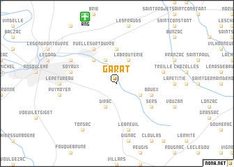
Garat (Poitou-Charentes, France)Garat is a town in the Poitou-Charentes region of France. An overview map of the region around Garat is displayed below.
regional and 3d topo map of Garat, France ::
Garat airports ::
The nearest airport is ANG - Angouleme Brie Champniers, located 11.2 km north of Garat.
Other airports nearby include CNG - Cognac Chateaubernard (45.6 km west), PGX - Perigueux Bassillac (64.7 km south east), LIG - Limoges Bellegarde (75.5 km east), NIT - Niort Souche (91.4 km north west), Nearby towns ::
Les Grands Moulins (3.2km south east) //
Dirac (3.9km south) //
La Brouterie (3.9km north) //
Touvre (3.9km north) //
Magnac-sur-Touvre (4.5km north west) //
Mornac (5.6km north) //
Bouëx (4.3km south east) //
Sers (5.4km south east) //
Ruelle-sur-Touvre (6.1km north west) //
Le Breuil (7.5km south) //
Treille (5.5km east) //
Soyaux (5.5km west) //
LʼIsle-dʼEspagnac (6.4km north west) //
Torsac (8.4km south west) //
[all distances 'as the bird flies' and approximate] 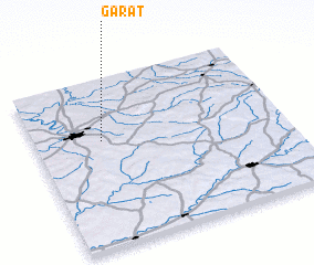 Places with similar names to Garat, France ::
Disclaimer :: Information on this page comes without warranty of any kind |
||
|
Where is Garat? Elevation and coordinates ::
Latitude (lat): 45°38'0"N Longitude (lon): 0°16'0"W
Elevation (approx.): 74m (map arrows pan, magnifying glasses zoom) |
||
|
Visiting Garat? Hotel/Accommodation ::
Book a hotel in Garat Travel Guide ::
Buy a travel guide for France rental cars ::
car rental offers GPS waypoint ::
download a GPX waypoint (PoI) of Garat for your GPS receiver
|
||