|
search place name
|
||
Gonnelieu (Nord-Pas-de-Calais, France)Gonnelieu is a town in the Nord-Pas-de-Calais region of France. An overview map of the region around Gonnelieu is displayed below.
regional and 3d topo map of Gonnelieu, France ::

Gonnelieu airports ::
The nearest airport is LIL - Lille Lesquin, located 57.1 km north of Gonnelieu.
Other airports nearby include QKT - Kortrijk-vevelgem Wevelgem (85.4 km north), CSF - Creil (99.6 km south west), BVA - Beauvais Tille (99.9 km south west), CRL - Charleroi Brussels South (103.5 km north east), Nearby towns ::
Villers-Guislain (1.9km south) //
Gouzeaucourt (2.4km west) //
Villers-Plouich (3.9km north) //
Bantouzelle (3.6km east) //
Épéhy (5.7km south) //
Honnecourt-sur-lʼEscaut (4.0km south east) //
Banteux (4.0km north east) //
Ribécourt-la-Tour (6.0km north west) //
Lempire (7.5km south) //
Ronssoy (7.5km south) //
Heudicourt (6.0km south west) //
Vendhuile (6.0km south east) //
Trescault (6.0km north west) //
Flesquières (7.8km north) //
Marcoing (7.8km north) //
Guyencourt-Saulcourt (7.3km south west) //
Villers-Faucon (8.2km south west) //
Bony (8.8km south east) //
Havrincourt (8.8km north west) //
Masnières (8.8km north east) //
[all distances 'as the bird flies' and approximate] 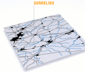 Places with similar names to Gonnelieu, France ::
Disclaimer :: Information on this page comes without warranty of any kind |
||
|
Where is Gonnelieu? Elevation and coordinates ::
Latitude (lat): 50°3'0"N Longitude (lon): 3°9'0"E
Elevation (approx.): 110m (map arrows pan, magnifying glasses zoom) |
||
|
Visiting Gonnelieu? Hotel/Accommodation ::
Book a hotel in Gonnelieu Travel Guide ::
Buy a travel guide for France rental cars ::
car rental offers GPS waypoint ::
download a GPX waypoint (PoI) of Gonnelieu for your GPS receiver
|
||