|
search place name
|
||
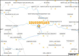
Goussargues (Languedoc-Roussillon, France)Goussargues is a town in the Languedoc-Roussillon region of France. An overview map of the region around Goussargues is displayed below.
regional and 3d topo map of Goussargues, France ::
Goussargues airports ::
The nearest airport is OBS - Aubenas-vals-lanas Ardeche Meridionale, located 40.6 km north of Goussargues.
Other airports nearby include FNI - Nimes Garons (47.4 km south), AVN - Avignon Caumont (47.5 km south east), MPL - Montpellier Mediterranee (78.0 km south west), MEN - Mende Brenoux (81.3 km north west), Nearby towns ::
Verfeuil (1.9km south) //
La Bastide (2.3km north east) //
Saint-André-dʼOlérargues (3.2km south east) //
Coulongres (3.9km south) //
Goudargues (3.9km north) //
Saint-Marcel-de-Careiret (4.6km south east) //
Cornillon (4.6km north east) //
Frigoulet (5.6km north) //
Saint-André-de-Roquepertuis (5.6km north) //
Fontarèches (7.4km south) //
La Roque-sur-Cèze (5.6km east) //
La Bruguière (7.9km south) //
Cavillargues (9.1km south east) //
[all distances 'as the bird flies' and approximate] 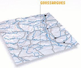 Places with similar names to Goussargues, France ::
// Czerkasy (PL)
// Czerkiesy (PL)
// Kisrákos (HU)
// Kisrécse (HU)
// Košrags (LV)
// Goose Rocks (US)
// Kusirakazi (ZM)
// Caissargues (FR)
// Coussergues (FR)
// Guizerix (FR)
Disclaimer :: Information on this page comes without warranty of any kind |
||
|
Where is Goussargues? Elevation and coordinates ::
Latitude (lat): 44°11'0"N Longitude (lon): 4°27'0"E
Elevation (approx.): 145m (map arrows pan, magnifying glasses zoom) |
||
|
Visiting Goussargues? Hotel/Accommodation ::
Book a hotel in Goussargues Travel Guide ::
Buy a travel guide for France rental cars ::
car rental offers GPS waypoint ::
download a GPX waypoint (PoI) of Goussargues for your GPS receiver
|
||