|
search place name
|
||
Guillerville (Haute-Normandie, France)Guillerville is a town in the Haute-Normandie region of France. An overview map of the region around Guillerville is displayed below.
regional and 3d topo map of Guillerville, France ::

Guillerville airports ::
The nearest airport is LEH - Le Havre Octeville, located 34.7 km west of Guillerville.
Other airports nearby include DOL - Deauville St Gatien (40.0 km south west), URO - Rouen Vallee De Seine (52.1 km south east), CFR - Caen Carpiquet (87.8 km south west), BVA - Beauvais Tille (114.5 km east), Nearby towns ::
Les Rouelles (1.9km north) //
Le Tronçay (1.2km east) //
Auzouville-Auberbosc (2.2km north east) //
Yébleron (2.2km north west) //
Bolleville (2.2km south east) //
Le Moulin (2.2km south west) //
Beau Soleil (3.0km north east) //
Auberbosc (3.0km north east) //
Hattenville (3.9km north) //
Raffetot (3.0km south west) //
Lanquetot (3.9km south) //
Fauville-en-Caux (4.4km north east) //
Bennetot (5.6km north) //
Foucart (3.6km east) //
Rouville (3.6km west) //
Ricarville (4.1km north east) //
Tennemare (4.1km north west) //
Alliquerville (4.1km south east) //
Le Faux Buisson (5.7km south) //
Lintot (5.7km south) //
Beuzevillette (5.7km south) //
Bielleville (5.2km north west) //
Toulifaut (6.1km north west) //
Trémauville (6.1km north west) //
Beauchêne (6.1km south west) //
Trouville (5.2km south east) //
Cléville (4.8km east) //
Bernières (4.8km west) //
La Trinité-du-Mont (7.4km south) //
[all distances 'as the bird flies' and approximate] 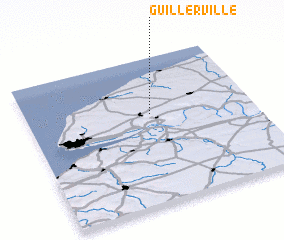 Places with similar names to Guillerville, France ::
// Claraville (US)
// Collierville (US)
// Kellerville (US)
// Kellerville (US)
// Clarevale (ZA)
// Clareville (NZ)
// Claryville (US)
// Claryville (US)
// Kellerville (US)
// Claryville (US)
Disclaimer :: Information on this page comes without warranty of any kind |
||
|
Where is Guillerville? Elevation and coordinates ::
Latitude (lat): 49°37'0"N Longitude (lon): 0°33'0"W
Elevation (approx.): 138m (map arrows pan, magnifying glasses zoom) |
||
|
Visiting Guillerville? Hotel/Accommodation ::
Book a hotel in Guillerville Travel Guide ::
Buy a travel guide for France rental cars ::
car rental offers GPS waypoint ::
download a GPX waypoint (PoI) of Guillerville for your GPS receiver
|
||