|
search place name
|
||
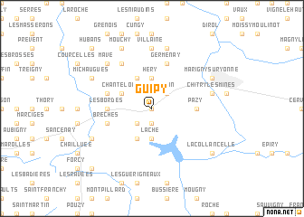
Guipy (Bourgogne, France)Guipy is a town in the Bourgogne region of France. An overview map of the region around Guipy is displayed below.
regional and 3d topo map of Guipy, France ::
Guipy airports ::
The nearest airport is NVS - Nevers Fourchambault, located 43.9 km south west of Guipy.
Other airports nearby include AUF - Auxerre Branches (68.9 km north), XMU - Moulins Montbeugny (78.6 km south), BOU - Bourges (94.0 km west), XCD - Chalon Champforgeuil (104.2 km south east), Nearby towns ::
La Trouillère (0.0km north) //
Vèvres (1.9km south) //
Beaumont (2.2km south west) //
La Brosse (2.2km south west) //
Ardan (2.2km north east) //
Laché (3.7km south) //
Héry (3.7km north) //
Vitry-Laché (3.9km south) //
Chanteloup (3.1km north west) //
Dompierre-sur-Héry (3.9km north) //
Pazy (3.8km east) //
Les Bordes (3.8km west) //
Brèches (4.2km south west) //
Beaulieu (4.2km north west) //
Germenay (5.7km north) //
Chazy (6.1km north west) //
Moraches (6.1km north west) //
Villaine (7.4km north) //
Cray (7.5km north) //
Chitry-les-Mines (5.4km east) //
Chaumot (5.4km east) //
Mavé (6.7km north west) //
Assarts (6.3km south west) //
Les Angles (6.3km south west) //
Michaugues (6.2km north west) //
Mouchy (7.8km north) //
Marigny-sur-Yonne (6.2km north east) //
La Collancelle (7.5km south east) //
Crux-la-Ville (9.0km south west) //
[all distances 'as the bird flies' and approximate] 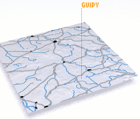 Places with similar names to Guipy, France ::
Disclaimer :: Information on this page comes without warranty of any kind |
||
|
Where is Guipy? Elevation and coordinates ::
Latitude (lat): 47°14'0"N Longitude (lon): 3°35'0"E
Elevation (approx.): 252m (map arrows pan, magnifying glasses zoom) |
||
|
Visiting Guipy? Hotel/Accommodation ::
Book a hotel in Guipy Travel Guide ::
Buy a travel guide for France rental cars ::
car rental offers GPS waypoint ::
download a GPX waypoint (PoI) of Guipy for your GPS receiver
|
||