|
search place name
|
||
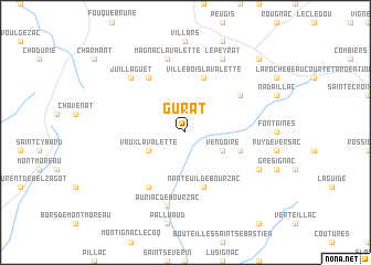
Gurat (Poitou-Charentes, France)Gurat is a town in the Poitou-Charentes region of France. An overview map of the region around Gurat is displayed below.
regional and 3d topo map of Gurat, France ::
Gurat airports ::
The nearest airport is ANG - Angouleme Brie Champniers, located 33.1 km north of Gurat.
Other airports nearby include PGX - Perigueux Bassillac (50.4 km south east), CNG - Cognac Chateaubernard (52.0 km north west), EGC - Bergerac Roumaniere (70.4 km south), LIG - Limoges Bellegarde (85.7 km north east), Nearby towns ::
Vendoire (3.2km south east) //
Vaux-Lavalette (3.2km south west) //
Villebois-Lavalette (5.7km north) //
Champagne-et-Fontaine (4.3km south east) //
Nanteuil-de-Bourzac (5.7km south) //
Ronsenac (6.1km north west) //
Blanzaguet-Saint-Cybard-le-Peyrat (5.4km north east) //
Salles-Lavalette (6.1km south west) //
Auriac-de-Bourzac (7.5km south) //
Magnac-Lavalette (7.5km north) //
Juillaguet (6.8km north west) //
La Chapelle-Grésignac (6.4km south east) //
Le Peyrat (7.9km north) //
Gardes-le-Pontaroux (9.1km north east) //
[all distances 'as the bird flies' and approximate] 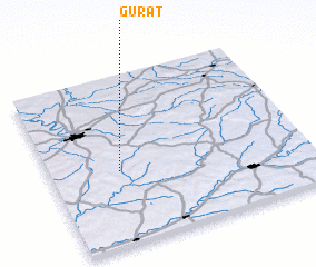 Places with similar names to Gurat, France ::
Disclaimer :: Information on this page comes without warranty of any kind |
||
|
Where is Gurat? Elevation and coordinates ::
Latitude (lat): 45°26'0"N Longitude (lon): 0°16'0"W
Elevation (approx.): 112m (map arrows pan, magnifying glasses zoom) |
||
|
Visiting Gurat? Hotel/Accommodation ::
Book a hotel in Gurat Travel Guide ::
Buy a travel guide for France rental cars ::
car rental offers GPS waypoint ::
download a GPX waypoint (PoI) of Gurat for your GPS receiver
|
||