|
search place name
|
||
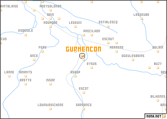
Gurmençon (Aquitaine, France)Gurmençon is a town in the Aquitaine region of France. An overview map of the region around Gurmençon is displayed below.
regional and 3d topo map of Gurmençon, France ::
Gurmençon airports ::
The nearest airport is PUF - Pau Pyrenees, located 29.5 km north east of Gurmençon.
Other airports nearby include LDE - Tarbes Lourdes (48.4 km east), BIQ - Biarritz-bayonne Anglet (82.8 km north west), PNA - Pamplona (95.2 km south west), EAS - San Sebastian (99.4 km west), Nearby towns ::
Arros-dʼOloron (0.0km north) //
Eysus (2.3km south east) //
Agnos (2.3km north west) //
Lurbe-Saint-Christau (3.9km south) //
Asasp (3.9km south) //
Oloron-Sainte-Marie (5.6km north) //
Goès (5.7km north) //
Précilhon (5.7km north) //
Escout (5.5km north east) //
Escot (7.4km south) //
Estos (7.5km north) //
Ledeuix (7.5km north) //
Herrère (5.7km east) //
Escou (6.6km north east) //
Issor (7.8km south west) //
Estialescq (8.4km north east) //
Moumour (9.2km north west) //
[all distances 'as the bird flies' and approximate] 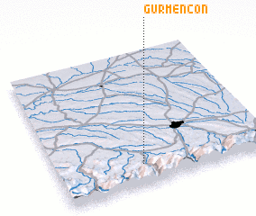 Places with similar names to Gurmençon, France ::
// Karmankino (RU)
// Krambangan (ID)
// Krembangan (ID)
// Karamančani (MK)
// Keur Ama Ngoné (SN)
// Kromnikón (GR)
Disclaimer :: Information on this page comes without warranty of any kind |
||
|
Where is Gurmençon? Elevation and coordinates ::
Latitude (lat): 43°9'0"N Longitude (lon): 0°36'0"W
Elevation (approx.): 269m (map arrows pan, magnifying glasses zoom) |
||
|
Visiting Gurmençon? Hotel/Accommodation ::
Book a hotel in Gurmençon Travel Guide ::
Buy a travel guide for France rental cars ::
car rental offers GPS waypoint ::
download a GPX waypoint (PoI) of Gurmençon for your GPS receiver
|
||