|
search place name
|
||
Hannonville-sous-les-Côtes (Lorraine, France)Hannonville-sous-les-Côtes is a town in the Lorraine region of France. An overview map of the region around Hannonville-sous-les-Côtes is displayed below.
regional and 3d topo map of Hannonville-sous-les-Côtes, France ::

Hannonville-sous-les-Côtes airports ::
The nearest airport is MZM - Metz Frescaty, located 34.3 km east of Hannonville-sous-les-Côtes.
Other airports nearby include ETZ - Metz Nancy Lorraine (43.2 km east), ENC - Nancy Essey (56.1 km south east), LUX - Luxemburg Luxembourg (77.0 km north east), EPL - Epinal Mirecourt (84.2 km south), Nearby towns ::
Thillot-sous-les-Côtes (1.9km south) //
Saint-Maurice-sous-les-Côtes (2.2km south east) //
Billy-sous-les-Côtes (2.2km south east) //
Avillers-Sainte-Croix (2.4km east) //
Viéville-sous-les-Côtes (3.9km south) //
Wadonville-en-Woëvre (3.9km north) //
Saulx-en-Woëvre (3.9km north) //
Combres-sous-les-Côtes (3.1km north west) //
Herbeuville (3.1km north west) //
Dommartin-la-Montagne (3.6km west) //
Marchéville-en-Woëvre (5.7km north) //
Champlon (5.7km north) //
Saint-Hilaire-en-Woëvre (6.1km north east) //
Hattonchâtel (6.1km south east) //
Woël (4.9km east) //
Creuë (7.4km south) //
Riaville (7.4km north) //
Saint-Rémy-la-Calonne (5.2km west) //
Butgnéville (6.6km north east) //
Hattonville (6.6km south east) //
Vigneulles-lès-Hattonchâtel (6.6km south east) //
Deuxnouds-aux-Bois (6.6km south west) //
Doncourt-aux-Templiers (6.1km north east) //
Maizeray (7.8km north) //
Trésauvaux (7.4km north west) //
Fresnes-en-Woëvre (8.3km north west) //
Moulotte (8.9km north east) //
Harville (8.9km north east) //
Bonzée-en-Woëvre (8.9km north west) //
[all distances 'as the bird flies' and approximate] 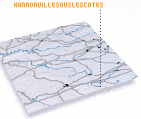 Places with similar names to Hannonville-sous-les-Côtes, France :: Disclaimer :: Information on this page comes without warranty of any kind |
||
|
Where is Hannonville-sous-les-Côtes? Elevation and coordinates ::
Latitude (lat): 49°2'0"N Longitude (lon): 5°40'0"E
Elevation (approx.): 238m (map arrows pan, magnifying glasses zoom) |
||
|
Visiting Hannonville-sous-les-Côtes? Hotel/Accommodation ::
Book a hotel in Hannonville-sous-les-Côtes Travel Guide ::
Buy a travel guide for France rental cars ::
car rental offers GPS waypoint ::
download a GPX waypoint (PoI) of Hannonville-sous-les-Côtes for your GPS receiver
|
||