|
search place name
|
||
Hattigny (Lorraine, France)Hattigny is a town in the Lorraine region of France. An overview map of the region around Hattigny is displayed below.
regional and 3d topo map of Hattigny, France ::

Hattigny airports ::
The nearest airport is SXB - Strassbourg Entzheim, located 49.9 km east of Hattigny.
Other airports nearby include ENC - Nancy Essey (54.6 km west), CMR - Colmar Houssen (65.1 km south east), ETZ - Metz Nancy Lorraine (65.3 km north west), SCN - Saarbruecken Saarbrucken (65.5 km north), Nearby towns ::
Fraquelfing (1.2km east) //
Aspach (1.9km north) //
Landange (3.7km north) //
Bertrambois (3.9km south) //
Laneuveville-lès-Lorquin (3.1km north east) //
Tanconville (4.4km south west) //
Lorquin (4.4km north east) //
Saint-Georges (4.4km north west) //
Niderhoff (3.7km east) //
Richeval (3.7km west) //
Neufmoulins (5.6km north) //
Cirey-sur-Vezouse (5.7km south) //
Hertzing (5.7km north) //
Lafrimbolle (5.2km south east) //
Gondrexange (6.1km north west) //
Val-et-Châtillon (7.4km south) //
Métairies-Saint-Quirin (4.9km east) //
Barchain (7.4km north) //
Ibigny (5.2km west) //
Héming (7.5km north) //
Hermelange (6.7km north east) //
Nitting (6.1km north east) //
Bébing (7.8km north) //
Xouaxange (7.8km north) //
[all distances 'as the bird flies' and approximate] 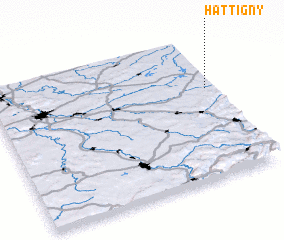 Places with similar names to Hattigny, France ::
// Hadiagan (PH)
// White Cone (US)
// Hato Guane (CU)
// Haţegana (RO)
// Hadgaon (IN)
// Hadakān (IR)
// Hedgān (IR)
// Hītkān (IR)
// Hodkūnū (IR)
// Ḩotkan (IR)
Disclaimer :: Information on this page comes without warranty of any kind |
||
|
Where is Hattigny? Elevation and coordinates ::
Latitude (lat): 48°38'0"N Longitude (lon): 6°58'0"E
Elevation (approx.): 297m (map arrows pan, magnifying glasses zoom) |
||
|
Visiting Hattigny? Hotel/Accommodation ::
Book a hotel in Hattigny Travel Guide ::
Buy a travel guide for France rental cars ::
car rental offers GPS waypoint ::
download a GPX waypoint (PoI) of Hattigny for your GPS receiver
|
||