|
search place name
|
||
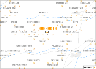
Hohwarth (Alsace, France)Hohwarth is a town in the Alsace region of France. An overview map of the region around Hohwarth is displayed below.
regional and 3d topo map of Hohwarth, France ::
Hohwarth airports ::
The nearest airport is CMR - Colmar Houssen, located 24.9 km south of Hohwarth.
Other airports nearby include SXB - Strassbourg Entzheim (30.7 km north east), ZCC - Baden-baden Baden Oos (80.1 km north east), MLH - Bale Mulhouse (83.8 km south), ENC - Nancy Essey (91.8 km north west), Nearby towns ::
Thanvillé (1.9km south) //
Saint-Pierre-Bois (1.2km east) //
Triembach-au-Val (1.2km west) //
Saint-Maurice (1.2km west) //
Dieffenbach-au-Val (2.2km south west) //
Neuve-Église (2.5km west) //
Albé (3.1km north west) //
Neubois (3.9km south) //
Reichsfeld (4.5km north east) //
Villé (3.7km west) //
Breitenau (4.1km south west) //
Saint-Martin (4.1km north west) //
Val-de-Villé (6.1km south east) //
Breitenbach (5.2km north west) //
Bernardvillé (5.2km north east) //
Bassemberg (4.9km west) //
Fouchy (4.9km west) //
Blienschwiller (4.9km east) //
Le Hohwald (7.5km north) //
Nothalten (5.3km east) //
Itterswiller (5.3km east) //
La Vancelle (6.7km south west) //
Dieffenthal (6.2km south east) //
Châtenois (8.3km south east) //
Andlau-au-Val (7.4km north east) //
Scherwiller (7.4km south east) //
Lièpvre (8.9km south west) //
[all distances 'as the bird flies' and approximate] 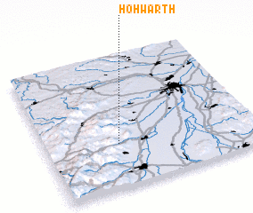 Places with similar names to Hohwarth, France ::
Disclaimer :: Information on this page comes without warranty of any kind |
||
|
Where is Hohwarth? Elevation and coordinates ::
Latitude (lat): 48°20'0"N Longitude (lon): 7°21'0"E
Elevation (approx.): 304m (map arrows pan, magnifying glasses zoom) |
||
|
Visiting Hohwarth? Hotel/Accommodation ::
Book a hotel in Hohwarth Travel Guide ::
Buy a travel guide for France rental cars ::
car rental offers GPS waypoint ::
download a GPX waypoint (PoI) of Hohwarth for your GPS receiver
|
||