|
search place name
|
||
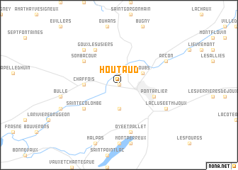
Houtaud (Franche-Comté, France)Houtaud is a town in the Franche-Comté region of France. An overview map of the region around Houtaud is displayed below.
regional and 3d topo map of Houtaud, France ::
Houtaud airports ::
The nearest airport is DLE - Dole Tavaux, located 69.0 km west of Houtaud.
Other airports nearby include GVA - Geneva Cointrin (77.1 km south), QNJ - Annemasse (80.6 km south), BRN - Bern Belp (89.9 km east), DIJ - Dijon Longvic (101.0 km north west), Nearby towns ::
Dommartin (0.0km north) //
Vuillecin (1.9km north) //
Granges-Narboz (3.7km south) //
Doubs (3.1km north east) //
Chaffois (3.8km west) //
Pontarlier (4.2km south east) //
Sombacour (5.3km north west) //
Goux-les-Usiers (6.1km north west) //
Sainte-Colombe (5.3km south west) //
Oye-et-Pallet (7.5km south) //
Bians-les-Usiers (6.7km north west) //
Arçon (6.3km north east) //
La Cluse et Mijoux (6.3km south east) //
[all distances 'as the bird flies' and approximate] 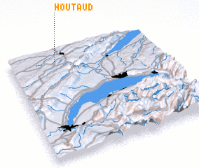 Places with similar names to Houtaud, France ::
Disclaimer :: Information on this page comes without warranty of any kind |
||
|
Where is Houtaud? Elevation and coordinates ::
Latitude (lat): 46°55'0"N Longitude (lon): 6°19'0"E
Elevation (approx.): 809m (map arrows pan, magnifying glasses zoom) |
||
|
Visiting Houtaud? Hotel/Accommodation ::
Book a hotel in Houtaud Travel Guide ::
Buy a travel guide for France rental cars ::
car rental offers GPS waypoint ::
download a GPX waypoint (PoI) of Houtaud for your GPS receiver
|
||