|
search place name
|
||
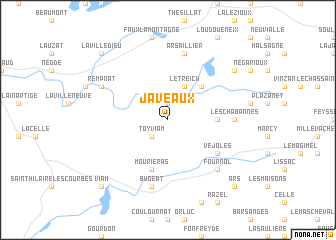
Javeaux (Limousin, France)Javeaux is a town in the Limousin region of France. An overview map of the region around Javeaux is displayed below.
regional and 3d topo map of Javeaux, France ::
Javeaux airports ::
The nearest airport is LIG - Limoges Bellegarde, located 63.8 km west of Javeaux.
Other airports nearby include BVE - Brive La Roche (68.6 km south west), MCU - Montlucon-gueret Montlucon Gueret (69.6 km north east), MCU - Montlucon Domerat (90.1 km north east), AUR - Aurillac (93.8 km south east), Nearby towns ::
Tarnac (1.9km north) //
Toy-Viam (2.3km south west) //
Le Treich (3.9km north) //
Chez Troussas (4.5km north east) //
Couffy (3.9km east) //
Mouriéras (5.7km south) //
Véjoles (5.4km south east) //
Les Chabannes (5.2km east) //
Arsaillier (7.5km north) //
Bugeat (7.5km south) //
Fournol (6.8km south east) //
Rempnat (6.4km north west) //
La Cour (7.6km north east) //
La Villedieu (9.0km north west) //
Viam (9.0km south west) //
Ars (9.0km south east) //
[all distances 'as the bird flies' and approximate] 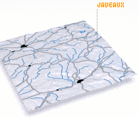
Disclaimer :: Information on this page comes without warranty of any kind |
||
|
Where is Javeaux? Elevation and coordinates ::
Latitude (lat): 45°40'0"N Longitude (lon): 1°57'0"E
Elevation (approx.): 802m (map arrows pan, magnifying glasses zoom) |
||
|
Visiting Javeaux? Hotel/Accommodation ::
Book a hotel in Javeaux Travel Guide ::
Buy a travel guide for France rental cars ::
car rental offers GPS waypoint ::
download a GPX waypoint (PoI) of Javeaux for your GPS receiver
|
||