|
search place name
|
||
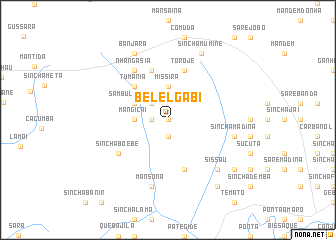
Belel Gabi (Guinea-Bissau)Belel Gabi is a town in Guinea-Bissau. An overview map of the region around Belel Gabi is displayed below.
regional and 3d topo map of Belel Gabi, Guinea-Bissau ::
Belel Gabi airports ::
The nearest airport is BXO - Bissau Oswaldo Vieira Intl, located 87.7 km south west of Belel Gabi.
Other airports nearby include ZIG - Ziguinchor (150.5 km west), CSK - Cap Skiring (198.0 km west), TUD - Tambacounda (215.3 km north east), BJL - Banjul Intl (222.1 km north west), Nearby towns ::
Boisanumã (0.0km north) //
Curauele (1.8km west) //
Madina Banjara (1.9km south) //
Belel (1.8km west) //
Bantajã (2.6km north west) //
Missirá (3.7km north) //
Bude (3.7km north) //
Mangicai (3.6km west) //
Sambulacunda (4.1km north west) //
Tumania (5.2km north west) //
Dembel Jule (5.8km south) //
Toroje (5.8km north) //
Mamboncò (5.8km north) //
Sinchã Boébè (6.6km south west) //
Nhangasia (6.6km north west) //
Sinchã Jobel (7.5km east) //
Sare Tambà (7.5km east) //
Sinchã Madina (7.5km east) //
Mansoná (7.6km south) //
Sissau (7.8km south east) //
Sinchã Mumine (8.3km north east) //
Banjara (8.3km north west) //
Dando (9.1km south east) //
Mansomine (9.2km south east) //
[all distances 'as the bird flies' and approximate] 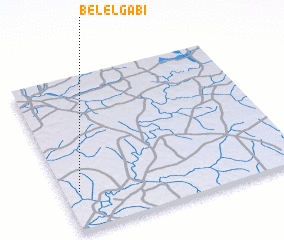 Places with similar names to Belel Gabi, Guinea-Bissau :: Disclaimer :: Information on this page comes without warranty of any kind |
||
|
Where is Belel Gabi? Elevation and coordinates ::
Latitude (lat): 12°15'0"N Longitude (lon): 14°56'0"W
Elevation (approx.): 20m (map arrows pan, magnifying glasses zoom) |
||
|
Visiting Belel Gabi? Hotel/Accommodation ::
Book a hotel in Belel Gabi Travel Guide ::
rental cars ::
car rental offers GPS waypoint ::
download a GPX waypoint (PoI) of Belel Gabi for your GPS receiver
|
||