|
search place name
|
||
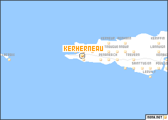
Kerherneau (Bretagne, France)Kerherneau is a town in the Bretagne region of France. An overview map of the region around Kerherneau is displayed below.
regional and 3d topo map of Kerherneau, France ::
Kerherneau airports ::
The nearest airport is UIP - Quimper Pluguffan, located 40.2 km east of Kerherneau.
Other airports nearby include BES - Brest Guipavas (50.6 km north east), MXN - Morlaix Ploujean (91.2 km north east), LRT - Lorient Lann Bihoue (99.0 km east), LAI - Lannion (121.3 km north east), Nearby towns ::
Pendreff (0.0km north) //
Lescoff (0.0km north) //
Trouguer (1.9km north) //
Kerloch (1.9km north) //
Kersaudy (2.2km north east) //
Saint-They (2.2km north west) //
Plogoff (2.5km east) //
Notre-Dame de Bon Voyage (3.7km east) //
Penaneach (3.7km east) //
Cléden-Cap-Sizun (4.2km north east) //
Lannoan (4.2km north east) //
Meseran (4.2km north east) //
Kermeur (5.2km north east) //
Le Loch (5.0km east) //
Keringar (5.0km east) //
Landrer (5.0km east) //
Trouguennour (5.3km east) //
[all distances 'as the bird flies' and approximate]  Places with similar names to Kerherneau, France ::
Disclaimer :: Information on this page comes without warranty of any kind |
||
|
Where is Kerherneau? Elevation and coordinates ::
Latitude (lat): 48°2'0"N Longitude (lon): 4°42'0"W
Elevation (approx.): 62m (map arrows pan, magnifying glasses zoom) |
||
|
Visiting Kerherneau? Hotel/Accommodation ::
Book a hotel in Kerherneau Travel Guide ::
Buy a travel guide for France rental cars ::
car rental offers GPS waypoint ::
download a GPX waypoint (PoI) of Kerherneau for your GPS receiver
|
||