|
search place name
|
||
Kervégant (Bretagne, France)Kervégant is a town in the Bretagne region of France. An overview map of the region around Kervégant is displayed below.
regional and 3d topo map of Kervégant, France ::

Kervégant airports ::
The nearest airport is LRT - Lorient Lann Bihoue, located 4.9 km south west of Kervégant.
Other airports nearby include VNE - Vannes Meucon (50.3 km east), UIP - Quimper Pluguffan (62.4 km west), SBK - St.-brieuc Armor Armor (92.7 km north east), MXN - Morlaix Ploujean (96.7 km north), Nearby towns ::
Keryado (1.9km south) //
Kerduale (2.2km south east) //
Tréfaven (2.2km south east) //
Kerforn (3.1km south) //
Kerentrech (2.9km south) //
Kerfichant (3.7km south) //
Le Mir (3.7km south) //
Quéven (2.5km west) //
LʼEau Courante (3.7km south) //
Kervarhic (4.0km south) //
La Ville en Bois (3.3km south east) //
Lorient (3.9km south) //
Kerbébon (3.1km north east) //
Kerlédern (3.9km south) //
Lanveur (4.2km south) //
Kerjulaude (4.4km south) //
Merville (4.4km south) //
Kerhono (3.6km south east) //
Keryvaland (4.6km south) //
Quéhellio-Sachoy (4.9km south) //
Kerolay (5.0km south) //
Carnel (5.0km south) //
Kervénanec (5.1km south) //
Penher (4.5km south east) //
Lanester (4.5km south east) //
Lainmat (4.5km north east) //
Kermélo (5.3km south) //
Kerbernès (5.2km south) //
Méné Guen (3.7km west) //
[all distances 'as the bird flies' and approximate] 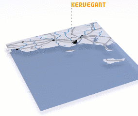
Disclaimer :: Information on this page comes without warranty of any kind |
||
|
Where is Kervégant? Elevation and coordinates ::
Latitude (lat): 47°47'0"N Longitude (lon): 3°23'0"W
Elevation (approx.): 4m (map arrows pan, magnifying glasses zoom) |
||
|
Visiting Kervégant? Hotel/Accommodation ::
Book a hotel in Kervégant Travel Guide ::
Buy a travel guide for France rental cars ::
car rental offers GPS waypoint ::
download a GPX waypoint (PoI) of Kervégant for your GPS receiver
|
||