|
search place name
|
||
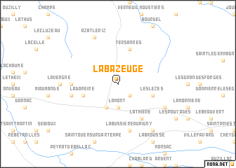
La Bazeuge (Limousin, France)La Bazeuge is a town in the Limousin region of France. An overview map of the region around La Bazeuge is displayed below.
regional and 3d topo map of La Bazeuge, France ::
La Bazeuge airports ::
The nearest airport is LIG - Limoges Bellegarde, located 43.5 km south of La Bazeuge.
Other airports nearby include PIS - Poitiers Biard (71.6 km north west), CHR - Chateauroux Deols (83.5 km north east), ANG - Angouleme Brie Champniers (89.3 km south west), MCU - Montlucon-gueret Montlucon Gueret (97.5 km east), Nearby towns ::
Dinsac (2.3km south east) //
Lamont (3.7km south) //
Le Dorat (3.9km south) //
Tersannes (5.7km north) //
Les Lezes (4.3km south east) //
La Dapeire (4.3km south west) //
Lathière (6.1km south east) //
Combrun (5.1km west) //
La Bussière-Aupigny (7.5km south) //
Oradour-Saint-Genest (5.5km west) //
Azat-le-Riz (7.8km north) //
Magnac-Laval (6.3km south east) //
Faye (8.4km south east) //
[all distances 'as the bird flies' and approximate] 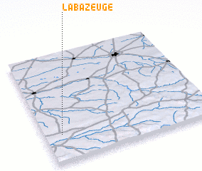
Disclaimer :: Information on this page comes without warranty of any kind |
||
|
Where is La Bazeuge? Elevation and coordinates ::
Latitude (lat): 46°15'0"N Longitude (lon): 1°6'0"E
Elevation (approx.): 216m (map arrows pan, magnifying glasses zoom) |
||
|
Visiting La Bazeuge? Hotel/Accommodation ::
Book a hotel in La Bazeuge Travel Guide ::
Buy a travel guide for France rental cars ::
car rental offers GPS waypoint ::
download a GPX waypoint (PoI) of La Bazeuge for your GPS receiver
|
||