|
search place name
|
||
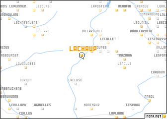
La Chaup (Provence-Alpes-Côte dʼAzur, France)La Chaup is a town in the Provence-Alpes-Côte dʼAzur region of France. An overview map of the region around La Chaup is displayed below.
regional and 3d topo map of La Chaup, France ::
La Chaup airports ::
The nearest airport is VAF - Valence Chabeuil, located 75.7 km west of La Chaup.
Other airports nearby include GNB - Grenoble Saint Geoirs (86.6 km north west), CMF - Chambery Aix Les Bains (106.1 km north), AVN - Avignon Caumont (115.6 km south west), OBS - Aubenas-vals-lanas Ardeche Meridionale (119.6 km west), Nearby towns ::
Agnières-en-Dévoluy (2.3km north east) //
Rioupes (3.2km north east) //
Villard-Joli (5.7km north) //
Truchières (5.7km north) //
Le Courtil (4.4km north east) //
La Cluse (5.7km south) //
Saint-Disdier-en-Dévoluy (6.2km north east) //
Le Collet (5.4km north east) //
Saint-Étienne-en-Dévoluy (5.6km east) //
[all distances 'as the bird flies' and approximate] 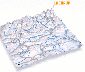 Places with similar names to La Chaup, France ::
Disclaimer :: Information on this page comes without warranty of any kind |
||
|
Where is La Chaup? Elevation and coordinates ::
Latitude (lat): 44°41'0"N Longitude (lon): 5°52'0"E
Elevation (approx.): 1348m (map arrows pan, magnifying glasses zoom) |
||
|
Visiting La Chaup? Hotel/Accommodation ::
Book a hotel in La Chaup Travel Guide ::
Buy a travel guide for France rental cars ::
car rental offers GPS waypoint ::
download a GPX waypoint (PoI) of La Chaup for your GPS receiver
|
||