|
search place name
|
||
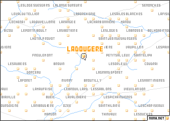
La Dougère (Basse-Normandie, France)La Dougère is a town in the Basse-Normandie region of France. An overview map of the region around La Dougère is displayed below.
regional and 3d topo map of La Dougère, France ::
La Dougère airports ::
The nearest airport is LME - Le Mans Arnage, located 76.2 km south west of La Dougère.
Other airports nearby include ORE - Orleans Bricy (82.0 km south east), TNF - Toussous-le-noble Toussus Le Noble (95.1 km east), URO - Rouen Vallee De Seine (105.8 km north), POX - Pontoise Cormeilles En Vexin (110.5 km north east), Nearby towns ::
La Madeleine-Bouvet (1.9km north) //
La Godefraise (1.2km east) //
Mesnault (2.2km north west) //
La Fosse (2.2km south east) //
Bretoncelles (2.2km south west) //
La Gilardière (3.1km north east) //
La Joignère (3.1km north west) //
La Folie (4.4km north east) //
Coulonges-les-Sablons (5.6km south) //
La Martinière (5.7km north) //
Brouin (4.1km south west) //
Broutilly (5.7km south) //
Moutiers-au-Perche (5.2km north west) //
La Sibotière (6.1km north west) //
Le Pas-Saint-lʼHomer (6.1km north east) //
La Grande Forêt (5.2km south east) //
Rivray (6.1km south west) //
Petits Alleux (4.9km east) //
Le Clos (5.3km east) //
Les Haies dʼAlleray (5.3km east) //
Les Orleux (5.3km east) //
La Brulardière (7.5km south) //
Le Brouillard (7.5km south) //
Les Loges (6.7km north east) //
La Chaussée (6.7km south west) //
Saint-Jean-des-Murgers (6.2km north east) //
Le Haut Bois (6.2km north east) //
La Charbonnière (7.8km north) //
La Rangée (7.8km north) //
[all distances 'as the bird flies' and approximate]  Places with similar names to La Dougère, France ::
// Laudigerie (FR)
// Laudigerie (FR)
// Leitgiriai (LT)
// La Tejera (ES)
// La Tejera (ES)
// La Tejera (ES)
// La Tejera (ES)
// Lletger (ES)
// La Tejería (EC)
// La Tejera (GT)
Disclaimer :: Information on this page comes without warranty of any kind |
||
|
Where is La Dougère? Elevation and coordinates ::
Latitude (lat): 48°27'0"N Longitude (lon): 0°54'0"W
Elevation (approx.): 163m (map arrows pan, magnifying glasses zoom) |
||
|
Visiting La Dougère? Hotel/Accommodation ::
Book a hotel in La Dougère Travel Guide ::
Buy a travel guide for France rental cars ::
car rental offers GPS waypoint ::
download a GPX waypoint (PoI) of La Dougère for your GPS receiver
|
||