|
search place name
|
||
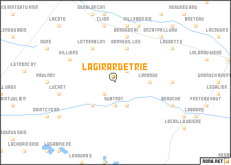
La Girardetrie (Centre, France)La Girardetrie is a town in the Centre region of France. An overview map of the region around La Girardetrie is displayed below.
regional and 3d topo map of La Girardetrie, France ::
La Girardetrie airports ::
The nearest airport is CHR - Chateauroux Deols, located 36.7 km east of La Girardetrie.
Other airports nearby include TUF - Tours Val De Loire (75.9 km north west), PIS - Poitiers Biard (77.8 km west), BOU - Bourges (88.4 km east), LIG - Limoges Bellegarde (109.9 km south), Nearby towns ::
Saulnay (2.2km north east) //
Marlange (2.2km south west) //
Subtray (3.7km south) //
Corbançon (3.9km south) //
Mézières-en-Brenne (4.5km south west) //
La Ronde (3.8km east) //
Arpheuilles (5.7km north) //
Le Tremblay (6.1km north west) //
Beaugerai (7.5km north) //
Villiers (6.3km north west) //
Onzay-Palluau (9.0km north east) //
[all distances 'as the bird flies' and approximate] 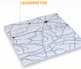 Places with similar names to La Girardetrie, France :: Disclaimer :: Information on this page comes without warranty of any kind |
||
|
Where is La Girardetrie? Elevation and coordinates ::
Latitude (lat): 46°51'0"N Longitude (lon): 1°15'0"E
Elevation (approx.): 131m (map arrows pan, magnifying glasses zoom) |
||
|
Visiting La Girardetrie? Hotel/Accommodation ::
Book a hotel in La Girardetrie Travel Guide ::
Buy a travel guide for France rental cars ::
car rental offers GPS waypoint ::
download a GPX waypoint (PoI) of La Girardetrie for your GPS receiver
|
||