|
search place name
|
||
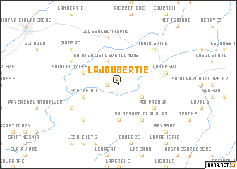
La Joubertie (Limousin, France)La Joubertie is a town in the Limousin region of France. An overview map of the region around La Joubertie is displayed below.
regional and 3d topo map of La Joubertie, France ::
La Joubertie airports ::
The nearest airport is BVE - Brive La Roche, located 33.2 km south of La Joubertie.
Other airports nearby include PGX - Perigueux Bassillac (48.3 km south west), LIG - Limoges Bellegarde (49.2 km north), ANG - Angouleme Brie Champniers (92.8 km west), EGC - Bergerac Roumaniere (93.1 km south west), Nearby towns ::
Ségur-le-Château (1.3km west) //
Saint-Julien-le-Vendômois (3.9km north) //
Arnac-Pompadour (3.2km south east) //
Lons (5.6km south) //
Le Méchenin (4.3km south west) //
Saint-Éloy-les-Tuileries (4.3km north west) //
Pompadour (5.4km south east) //
Saint-Sornin-Lavolps (6.1km south east) //
Coussac-Bonneval (7.5km north) //
Lubersac (5.5km east) //
Tournevite (6.8km north east) //
Saint-Cyr-les-Champagnes (6.8km south west) //
Beyssenac (6.4km south west) //
La Ribière (6.4km north west) //
Quinsac (7.6km north west) //
Beyssac (9.1km south east) //
[all distances 'as the bird flies' and approximate] 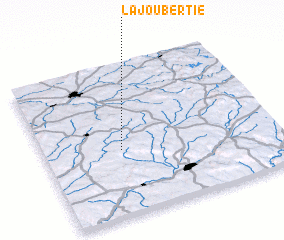 Places with similar names to La Joubertie, France ::
// Ljuberađa (CS)
Disclaimer :: Information on this page comes without warranty of any kind |
||
|
Where is La Joubertie? Elevation and coordinates ::
Latitude (lat): 45°26'0"N Longitude (lon): 1°20'0"E
Elevation (approx.): 342m (map arrows pan, magnifying glasses zoom) |
||
|
Visiting La Joubertie? Hotel/Accommodation ::
Book a hotel in La Joubertie Travel Guide ::
Buy a travel guide for France rental cars ::
car rental offers GPS waypoint ::
download a GPX waypoint (PoI) of La Joubertie for your GPS receiver
|
||