|
search place name
|
||
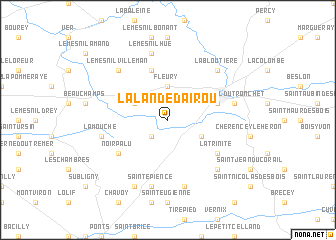
La Lande-dʼAirou (Basse-Normandie, France)La Lande-dʼAirou is a town in the Basse-Normandie region of France. An overview map of the region around La Lande-dʼAirou is displayed below.
regional and 3d topo map of La Lande-dʼAirou, France ::
La Lande-dʼAirou airports ::
The nearest airport is DNR - Dinard Pleurtuit, located 63.9 km south west of La Lande-dʼAirou.
Other airports nearby include CFR - Caen Carpiquet (72.7 km north east), JER - Jersey (79.7 km north west), RNS - Rennes St Jacques (89.5 km south), CER - Cherbourg Maupertus (93.7 km north), Nearby towns ::
Bourguenolles (2.2km south west) //
Fleury (3.7km north) //
Rouffigny (3.1km south east) //
Champrépus (3.1km north west) //
Saultchevreuil-du-Tronchet (4.1km north east) //
Le Mesnil-Garnier (5.7km north) //
Noirpalu (5.2km south west) //
La Trinité (5.2km south east) //
Villedieu-les-Poëles (5.2km east) //
Le Mesnil-Hue (7.5km north) //
Braffais (7.5km south) //
Sainte-Pience (7.5km south) //
La Mouche (5.2km west) //
La Chaise-Beaudouin (6.7km south east) //
La Bloutière (6.7km north east) //
Le Mesnil-Villeman (6.7km north west) //
Le Luot (7.8km south) //
[all distances 'as the bird flies' and approximate] 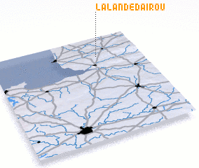 Places with similar names to La Lande-dʼAirou, France :: Disclaimer :: Information on this page comes without warranty of any kind |
||
|
Where is La Lande-dʼAirou? Elevation and coordinates ::
Latitude (lat): 48°49'0"N Longitude (lon): 1°17'0"W
Elevation (approx.): 105m (map arrows pan, magnifying glasses zoom) |
||
|
Visiting La Lande-dʼAirou? Hotel/Accommodation ::
Book a hotel in La Lande-dʼAirou Travel Guide ::
Buy a travel guide for France rental cars ::
car rental offers GPS waypoint ::
download a GPX waypoint (PoI) of La Lande-dʼAirou for your GPS receiver
|
||