|
search place name
|
||
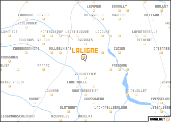
La Ligne (Centre, France)La Ligne is a town in the Centre region of France. An overview map of the region around La Ligne is displayed below.
regional and 3d topo map of La Ligne, France ::
La Ligne airports ::
The nearest airport is CHR - Chateauroux Deols, located 46.5 km north of La Ligne.
Other airports nearby include MCU - Montlucon-gueret Montlucon Gueret (69.5 km south east), LIG - Limoges Bellegarde (72.5 km south), MCU - Montlucon Domerat (80.7 km east), BOU - Bourges (91.7 km north east), Nearby towns ::
Bazaiges (3.7km north) //
Peugueffier (3.7km south) //
Baraize (3.2km north east) //
La Bétoulle (5.7km south) //
Villebuxière (4.3km north west) //
Le Petit-Vavre (5.7km north) //
Chantôme (5.7km south) //
Éguzon (4.3km south east) //
Célon (6.1km north west) //
La Prune (6.1km north east) //
Saint-Sébastien (7.4km south) //
Saint-Gilles (5.4km west) //
Cuzion (5.4km east) //
Fressine (5.4km east) //
Vigoux (6.8km north west) //
Badecon-le-Pin (6.8km north east) //
Ceaulmont (6.8km north east) //
Montbaltruy (7.5km north west) //
Gargilesse-Dampierre (7.5km north east) //
LʼAumône (9.0km south west) //
[all distances 'as the bird flies' and approximate] 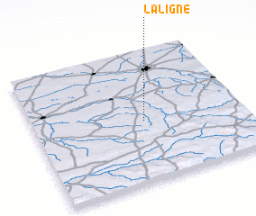 Places with similar names to La Ligne, France ::
Disclaimer :: Information on this page comes without warranty of any kind |
||
|
Where is La Ligne? Elevation and coordinates ::
Latitude (lat): 46°28'0"N Longitude (lon): 1°32'0"E
Elevation (approx.): 266m (map arrows pan, magnifying glasses zoom) |
||
|
Visiting La Ligne? Hotel/Accommodation ::
Book a hotel in La Ligne Travel Guide ::
Buy a travel guide for France rental cars ::
car rental offers GPS waypoint ::
download a GPX waypoint (PoI) of La Ligne for your GPS receiver
|
||