|
search place name
|
||
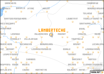
Lambertèche (Auvergne, France)Lambertèche is a town in the Auvergne region of France. An overview map of the region around Lambertèche is displayed below.
regional and 3d topo map of Lambertèche, France ::
Lambertèche airports ::
The nearest airport is CFE - Clermont Ferrand Auvergne, located 20.1 km south east of Lambertèche.
Other airports nearby include VHY - Vichy Charmeil (47.4 km north east), MCU - Montlucon-gueret Montlucon Gueret (59.0 km north west), MCU - Montlucon Domerat (59.8 km north west), XMU - Moulins Montbeugny (81.1 km north east), Nearby towns ::
Verrière (1.9km north) //
Pogniat (2.6km east) //
Pulvérières (2.6km west) //
Vauriat (3.2km south west) //
Beauregard (3.9km south) //
Moullet (3.9km east) //
Cratère (4.3km south east) //
Charbonnières-lès-Varennes (4.3km north east) //
Saint-Ours (5.4km south west) //
Les Fontêtes (6.1km south west) //
Beauloup (6.1km south west) //
Les Maisons Rouges (6.1km south west) //
Villelongue (5.5km west) //
Le Cheix (5.5km west) //
Égaule (6.8km south east) //
La Courteix (6.8km south west) //
Chanat-la-Mouteyre (7.6km south east) //
Loubeyrat (7.6km north east) //
Ternant (9.0km south east) //
[all distances 'as the bird flies' and approximate] 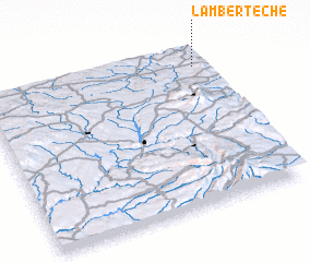 Places with similar names to Lambertèche, France :: Disclaimer :: Information on this page comes without warranty of any kind |
||
|
Where is Lambertèche? Elevation and coordinates ::
Latitude (lat): 45°53'0"N Longitude (lon): 2°57'0"E
Elevation (approx.): 825m (map arrows pan, magnifying glasses zoom) |
||
|
Visiting Lambertèche? Hotel/Accommodation ::
Book a hotel in Lambertèche Travel Guide ::
Buy a travel guide for France rental cars ::
car rental offers GPS waypoint ::
download a GPX waypoint (PoI) of Lambertèche for your GPS receiver
|
||