|
search place name
|
||
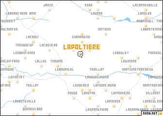
La Poltière (Bretagne, France)La Poltière is a town in the Bretagne region of France. An overview map of the region around La Poltière is displayed below.
regional and 3d topo map of La Poltière, France ::
La Poltière airports ::
The nearest airport is RNS - Rennes St Jacques, located 31.9 km north west of La Poltière.
Other airports nearby include LVA - Laval Entrammes (54.7 km east), NTE - Nantes Atlantique (80.4 km south), SNR - St.-nazaire Montoir (81.8 km south west), DNR - Dinard Pleurtuit (93.5 km north west), Nearby towns ::
Coësmes (1.9km north) //
Laignière (2.2km north east) //
Sainte-Colombe (2.2km north west) //
Champagne (3.7km north) //
Thiellay (4.5km south east) //
Soulvache (4.5km south west) //
Le Bouridel (4.5km south west) //
Le Theil-de-Bretagne (5.6km north) //
Thourie (4.2km south west) //
La Bourginière (6.1km south east) //
Le Rocher (7.4km south) //
La Couyère (5.3km west) //
Fercé (7.5km south) //
Retiers (6.7km north east) //
La Fourcherie (8.3km south east) //
[all distances 'as the bird flies' and approximate] 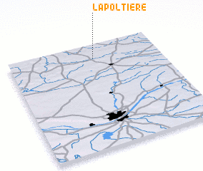 Places with similar names to La Poltière, France ::
// La Piladora (CO)
// La Pildora (VE)
// La Platera (VE)
// La Platera (VE)
// La Platera (VE)
// La Pelleterie (FR)
// La Poultière (FR)
// Le Plâtre (FR)
Disclaimer :: Information on this page comes without warranty of any kind |
||
|
Where is La Poltière? Elevation and coordinates ::
Latitude (lat): 47°52'0"N Longitude (lon): 1°26'0"W
Elevation (approx.): 89m (map arrows pan, magnifying glasses zoom) |
||
|
Visiting La Poltière? Hotel/Accommodation ::
Book a hotel in La Poltière Travel Guide ::
Buy a travel guide for France rental cars ::
car rental offers GPS waypoint ::
download a GPX waypoint (PoI) of La Poltière for your GPS receiver
|
||