|
search place name
|
||
La Rochotte (Bourgogne, France)La Rochotte is a town in the Bourgogne region of France. An overview map of the region around La Rochotte is displayed below.
regional and 3d topo map of La Rochotte, France ::

La Rochotte airports ::
The nearest airport is DIJ - Dijon Longvic, located 31.6 km south east of La Rochotte.
Other airports nearby include XCD - Chalon Champforgeuil (66.0 km south), DLE - Dole Tavaux (67.3 km south east), AUF - Auxerre Branches (104.7 km north west), QYR - Troyes Barberey (114.1 km north west), Nearby towns ::
Bligny-le-Sec (1.9km north) //
Turcey (2.2km south west) //
Trouhaut (2.2km south east) //
Villotte-Saint-Seine (3.1km north west) //
Blaisy-Bas (5.6km south) //
Bordes-Bricard (3.8km east) //
Saint-Martin-du-Mont (4.2km north east) //
Saint-Seine-lʼAbbaye (4.2km north east) //
Froideville (4.2km north east) //
Champrenault (4.2km south west) //
Fromenteau (4.2km south east) //
Bussy-la-Pesle (6.1km south west) //
Champagny (6.1km north east) //
Saint-Hélier (5.3km south west) //
Charencey Bas (5.0km west) //
Charencey Haut (5.0km west) //
Charencey (5.0km west) //
Verrey-sous-Salmaise (5.3km west) //
La Bonde (5.3km west) //
Cestres (5.3km east) //
Blaisy-Haut (7.5km south) //
Bordes-Pillot (5.3km east) //
Verrey-sous-Drée (6.7km south west) //
Charmoy (6.7km south east) //
Salmaise (6.2km north west) //
Présilly (7.5km north west) //
Fontette (7.5km south west) //
Blessey (8.3km north west) //
Vaux-Saules (7.5km north east) //
[all distances 'as the bird flies' and approximate] 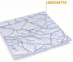 Places with similar names to La Rochotte, France ::
// Larochette (LU)
// Lârichat (MA)
// La Rochette (FR)
// La Rochette (FR)
// La Rochette (FR)
// Le Ruchet (FR)
// La Rochette (FR)
// La Rochette (FR)
// La Rochette (FR)
// La Rochette (FR)
Disclaimer :: Information on this page comes without warranty of any kind |
||
|
Where is La Rochotte? Elevation and coordinates ::
Latitude (lat): 47°25'0"N Longitude (lon): 4°44'0"E
Elevation (approx.): 549m (map arrows pan, magnifying glasses zoom) |
||
|
Visiting La Rochotte? Hotel/Accommodation ::
Book a hotel in La Rochotte Travel Guide ::
Buy a travel guide for France rental cars ::
car rental offers GPS waypoint ::
download a GPX waypoint (PoI) of La Rochotte for your GPS receiver
|
||