|
search place name
|
||
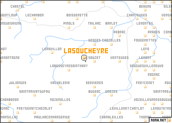
La Soucheyre (Auvergne, France)La Soucheyre is a town in the Auvergne region of France. An overview map of the region around La Soucheyre is displayed below.
regional and 3d topo map of La Soucheyre, France ::
La Soucheyre airports ::
The nearest airport is LPY - Le Puy Loudes, located 26.9 km north east of La Soucheyre.
Other airports nearby include MEN - Mende Brenoux (53.9 km south), AUR - Aurillac (81.8 km west), OBS - Aubenas-vals-lanas Ardeche Meridionale (87.8 km south east), EBU - St.-etienne Boutheon (90.8 km north east), Nearby towns ::
Sauzet (1.3km east) //
La Besseyre-Saint-Mary (3.2km south west) //
Auvers (3.2km north west) //
Desges (3.9km north) //
Servières (5.7km south) //
Chazelles (5.4km north east) //
Venteuges (5.2km east) //
Bugeac (7.5km south) //
Tailhac (7.5km north) //
Le Pavillon (5.6km west) //
Vachelerie (6.8km south west) //
Pinols (7.9km north) //
Grèzes (8.4km south east) //
Barlet (8.4km north east) //
Pébrac (7.6km north east) //
[all distances 'as the bird flies' and approximate] 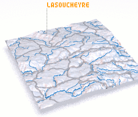 Places with similar names to La Soucheyre, France ::
Disclaimer :: Information on this page comes without warranty of any kind |
||
|
Where is La Soucheyre? Elevation and coordinates ::
Latitude (lat): 44°59'0"N Longitude (lon): 3°27'0"E
Elevation (approx.): 1155m (map arrows pan, magnifying glasses zoom) |
||
|
Visiting La Soucheyre? Hotel/Accommodation ::
Book a hotel in La Soucheyre Travel Guide ::
Buy a travel guide for France rental cars ::
car rental offers GPS waypoint ::
download a GPX waypoint (PoI) of La Soucheyre for your GPS receiver
|
||