|
search place name
|
||
La Testa (France)La Testa is a town in France. An overview map of the region around La Testa is displayed below.
regional and 3d topo map of La Testa, France ::

La Testa airports ::
The nearest airport is FSC - Figari Sud Corse, located 5.7 km north of La Testa.
Other airports nearby include AJA - Ajaccio Campo Dell Oro (57.6 km north west), SOZ - Solenzara (59.1 km north east), OLB - Olbia Costa Smeralda (71.3 km south east), AHO - Alghero (112.7 km south west), Nearby towns ::
Viagenti (4.6km north west) //
Pianottoli-Caldarello (4.6km north west) //
Tivarello (5.6km north east) //
Poggiale (7.4km north) //
San-Gavino (7.5km north) //
Ogliastrello (6.9km north east) //
Vallicelo (7.9km north) //
Tarrabucceta (8.5km north east) //
Monacia-dʼAullène (9.3km north west) //
Pruno (9.3km north east) //
Bonifacio (9.3km south east) //
[all distances 'as the bird flies' and approximate] 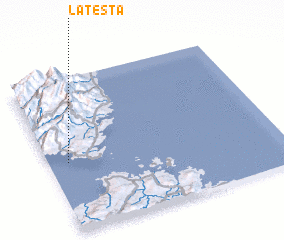 Places with similar names to La Testa, France ::
// Ludastó (HU)
// La Deseada (CU)
// La Deseada (CU)
// Lădeşti (RO)
// Lăţeşti (RO)
// Leoteşti (RO)
// Leţeşti (RO)
// Ludeşti (RO)
// Lodosoit (KE)
// La Deseada (MX)
Disclaimer :: Information on this page comes without warranty of any kind |
||
|
Where is La Testa? Elevation and coordinates ::
Latitude (lat): 41°27'0"N Longitude (lon): 9°5'0"E
Elevation (approx.): 33m (map arrows pan, magnifying glasses zoom) |
||
|
Visiting La Testa? Hotel/Accommodation ::
Book a hotel in La Testa Travel Guide ::
Buy a travel guide for France rental cars ::
car rental offers GPS waypoint ::
download a GPX waypoint (PoI) of La Testa for your GPS receiver
|
||