|
search place name
|
||
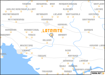
La Trinité (Bretagne, France)La Trinité is a town in the Bretagne region of France. An overview map of the region around La Trinité is displayed below.
regional and 3d topo map of La Trinité, France ::
La Trinité airports ::
The nearest airport is UIP - Quimper Pluguffan, located 27.0 km west of La Trinité.
Other airports nearby include LRT - Lorient Lann Bihoue (33.1 km south east), BES - Brest Guipavas (74.1 km north west), MXN - Morlaix Ploujean (76.3 km north), VNE - Vannes Meucon (85.0 km east), Nearby towns ::
Melgven (2.2km south west) //
Barbary (2.5km east) //
Cadol (3.1km north west) //
Kernével (4.5km north east) //
Rosporden (5.7km north) //
Kerouac (7.4km north) //
Trouce (5.0km west) //
Penhoat Cadol (5.3km west) //
Locjean (7.5km north) //
Nizon (6.7km south east) //
Botbodern (7.8km north) //
Trégunc (7.8km south) //
Quistinit (8.3km north east) //
Kerviniou (7.5km south west) //
Saint-Guénolé (8.9km north east) //
Pont-Aven (8.9km south east) //
[all distances 'as the bird flies' and approximate] 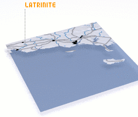 Places with similar names to La Trinité, France ::
// Lautaranta (RU)
// La Trinité (FR)
// La Trinité (FR)
// La Trinité (FR)
// La Trinité (FR)
// Lähderanta (FI)
// Lahtiranta (FI)
// Lauttaranta (FI)
// Lehtoranta (FI)
// Lehtorinta (FI)
Disclaimer :: Information on this page comes without warranty of any kind |
||
|
Where is La Trinité? Elevation and coordinates ::
Latitude (lat): 47°55'0"N Longitude (lon): 3°49'0"W
Elevation (approx.): 80m (map arrows pan, magnifying glasses zoom) |
||
|
Visiting La Trinité? Hotel/Accommodation ::
Book a hotel in La Trinité Travel Guide ::
Buy a travel guide for France rental cars ::
car rental offers GPS waypoint ::
download a GPX waypoint (PoI) of La Trinité for your GPS receiver
|
||