|
search place name
|
||
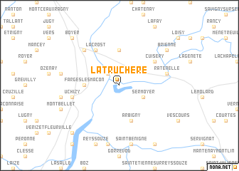
La Truchère (Bourgogne, France)La Truchère is a town in the Bourgogne region of France. An overview map of the region around La Truchère is displayed below.
regional and 3d topo map of La Truchère, France ::
La Truchère airports ::
The nearest airport is QNX - Macon Charnay, located 27.3 km south west of La Truchère.
Other airports nearby include XCD - Chalon Champforgeuil (35.9 km north), XBK - Bourg Ceyzeriat (43.9 km south east), DLE - Dole Tavaux (68.6 km north east), XVF - Vilefrance Tarare (72.5 km south), Nearby towns ::
Préty (2.2km north west) //
Le Villars (2.2km north west) //
Sermoyer (3.2km south east) //
LʼAbergement-de-Cuisery (5.6km north) //
Farges-lès-Mâcon (3.8km west) //
Arbigny (5.7km south) //
Cuisery (5.3km north east) //
Lacrost (6.1km north west) //
Ratenelle (5.4km east) //
Uchizy (5.4km west) //
Tournus (6.7km north west) //
Brienne (7.5km north east) //
Boyer (9.0km north west) //
Fleurville (9.0km south west) //
[all distances 'as the bird flies' and approximate] 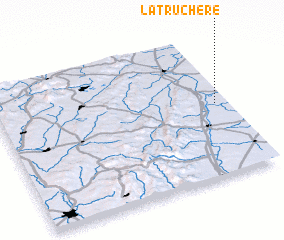 Places with similar names to La Truchère, France ::
Disclaimer :: Information on this page comes without warranty of any kind |
||
|
Where is La Truchère? Elevation and coordinates ::
Latitude (lat): 46°31'0"N Longitude (lon): 4°57'0"E
Elevation (approx.): 174m (map arrows pan, magnifying glasses zoom) |
||
|
Visiting La Truchère? Hotel/Accommodation ::
Book a hotel in La Truchère Travel Guide ::
Buy a travel guide for France rental cars ::
car rental offers GPS waypoint ::
download a GPX waypoint (PoI) of La Truchère for your GPS receiver
|
||