|
search place name
|
||
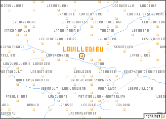
La Villedieu (Centre, France)La Villedieu is a town in the Centre region of France. An overview map of the region around La Villedieu is displayed below.
regional and 3d topo map of La Villedieu, France ::
La Villedieu airports ::
The nearest airport is ORE - Orleans Bricy, located 85.5 km south east of La Villedieu.
Other airports nearby include LME - Le Mans Arnage (85.5 km south west), TNF - Toussous-le-noble Toussus Le Noble (88.6 km east), URO - Rouen Vallee De Seine (96.0 km north), POX - Pontoise Cormeilles En Vexin (101.7 km north east), Nearby towns ::
Le Long de Bois (1.2km east) //
LʼOiserie (1.2km east) //
Les Menus (2.2km south west) //
La Charbonnière (2.2km south west) //
Neuilly-sur-Eure (2.5km west) //
Les Ailes Blanches (2.5km east) //
Les Loges (3.7km south) //
Manou (3.1km south east) //
Le Pas-Saint-lʼHomer (3.9km south) //
La Bécanne (3.9km south) //
La Martinière (4.4km south west) //
La Porcherie (3.7km west) //
Prebrout (5.7km north) //
La Folie (5.7km south) //
Saint-Jean-des-Murgers (5.7km south) //
Le Haut Bois (5.7km south) //
La Pommarerie (6.1km north west) //
La Brosse (5.2km south east) //
Le Chêne dʼAuvilliers (5.2km north west) //
Laudigerie (5.2km north east) //
La Gilardière (7.5km south) //
Les Haies dʼAlleray (7.5km south) //
Le Clos (7.5km south) //
Les Ressuintes (7.5km north) //
La Puisaye (7.5km north) //
Tardais (6.7km north east) //
Meaucé (6.7km south east) //
Floudière (7.8km north) //
Fontaine-Simon (6.2km south east) //
[all distances 'as the bird flies' and approximate]  Places with similar names to La Villedieu, France ::
Disclaimer :: Information on this page comes without warranty of any kind |
||
|
Where is La Villedieu? Elevation and coordinates ::
Latitude (lat): 48°32'0"N Longitude (lon): 0°57'0"W
Elevation (approx.): 218m (map arrows pan, magnifying glasses zoom) |
||
|
Visiting La Villedieu? Hotel/Accommodation ::
Book a hotel in La Villedieu Travel Guide ::
Buy a travel guide for France rental cars ::
car rental offers GPS waypoint ::
download a GPX waypoint (PoI) of La Villedieu for your GPS receiver
|
||