|
search place name
|
||
LʼÉcharenne (Rhône-Alpes, France)LʼÉcharenne is a town in the Rhône-Alpes region of France. An overview map of the region around LʼÉcharenne is displayed below.
regional and 3d topo map of LʼÉcharenne, France ::

LʼÉcharenne airports ::
The nearest airport is VAF - Valence Chabeuil, located 67.4 km west of LʼÉcharenne.
Other airports nearby include GNB - Grenoble Saint Geoirs (68.7 km north west), CMF - Chambery Aix Les Bains (87.7 km north), LYS - Lyon Saint Exupery (112.8 km north west), LYN - Lyon Bron (119.1 km north west), Nearby towns ::
Saint-Sébastien (1.3km west) //
Les Bayles (2.3km north west) //
Saint-Pierre-de-Méaroz (3.7km north) //
Ponsonnas (3.9km north) //
Cordéac (3.2km south east) //
Les Gautiers (3.2km south east) //
Les Souchons (3.2km north east) //
Chalanne (3.2km south east) //
Masserange (3.2km north west) //
Les Rieux (4.5km north east) //
Saint-Laurent-en-Beaumont (4.5km north east) //
Cognet (4.5km north west) //
Saint-Jean-dʼHérans (3.9km west) //
Siévoz (5.7km north) //
Ser Clapi (4.4km south west) //
La Salle-en-Beaumont (4.4km north east) //
Quet-en-Beaumont (4.4km south east) //
Haut-Quet (4.4km south east) //
Les Rives (4.4km north west) //
Longueville (5.7km south) //
Chalméane (5.4km north east) //
Prunières (5.4km north west) //
Saint-Genis (5.4km south west) //
La Mure (6.1km north west) //
La Faury (7.5km north) //
Pont du Prêtre (6.8km north east) //
Menglas (6.8km south west) //
La Croix de la Pigne (6.4km south east) //
Mens (6.4km south west) //
[all distances 'as the bird flies' and approximate] 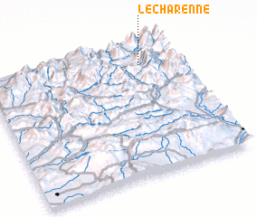 Places with similar names to LʼÉcharenne, France ::
// Lochearn (US)
// Lecherón (EC)
// Lishāran (PK)
// La Achirana (PE)
// La Cherna (VE)
// Losh Run (US)
// La Cherna (VE)
// Lacharani (BO)
// La Charnay (FR)
// La Charnée (FR)
Disclaimer :: Information on this page comes without warranty of any kind |
||
|
Where is LʼÉcharenne? Elevation and coordinates ::
Latitude (lat): 44°51'0"N Longitude (lon): 5°49'0"E
Elevation (approx.): 843m (map arrows pan, magnifying glasses zoom) |
||
|
Visiting LʼÉcharenne? Hotel/Accommodation ::
Book a hotel in LʼÉcharenne Travel Guide ::
Buy a travel guide for France rental cars ::
car rental offers GPS waypoint ::
download a GPX waypoint (PoI) of LʼÉcharenne for your GPS receiver
|
||